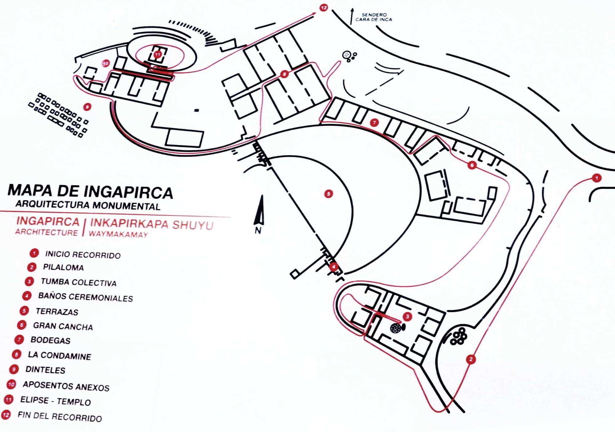
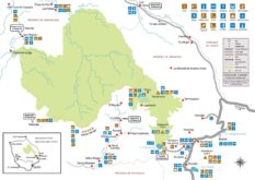
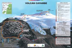
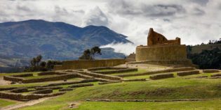
Here find a tourist map of the Ingapirca Ruins located in the province of Cañar in the Ecuadorian Andes. Need more information about traveling to Ecuador? Click here to see more Ecuador travel maps or Click here to see more resources on how to prepare your trip.
Tourist Map of the Ingapirca Ruins
Map of Ingapirca Ruins, Ecuador. Free download. Image
1 file(s) 129 KB
Map of Ingapirca Ruins, Ecuador. Free download. PDF
1 file(s) 210 KB
Source: Ecuador National Tourism Office (Ministerio de Turismo)
Top tourist attractions
Cañar province
Cañar is an Ecuadorian province rich in cultural traditions. Its capital is Azogues. Cañar is the ancestral home of the indigenous Cañari people — hence its name — Cañaris have lived in this region of Ecuador for many years. This province also has interesting indigenous markets and lakes. Besides Azogues another popular destination is Biblián, due to La Virgen del Rocío church. Another popular attraction is the Cañari-Incan Ruins of Ingapirca.
Sanctuary of the Virgen del Rocio is a beautiful place located in the town of Biblian, in the province of Cañar, Ecuador. Church has a gothic style, built on the ...
Culebrillas Lake is one of the landmarks of the Inca Trail - The Inca Trail is by one of the most famous treks in Ecuador. In fact, it is a popular ...
Ingapirca Inca Ruins are the best-preserved ruins in Ecuador. Ingapirca means "Inka Pirka" in Quechua (Wall of the Inca). This archaeological discovery protects the memory of the Incas that once walked ...
Sanctuary Our Lady of the Cloud also known as "San Francisco Church," in Spanish "Santuario de la Virgen de las Nubes," or "La Catedral de Azogues". This sanctuary is located at ...