Pacific Coast (Costa Region)

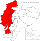
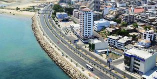
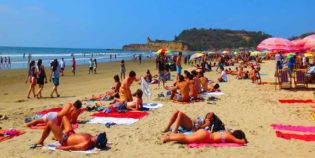
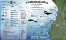
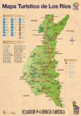
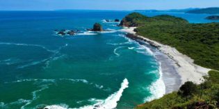
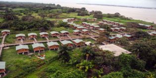
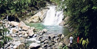
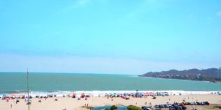
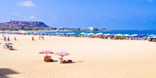
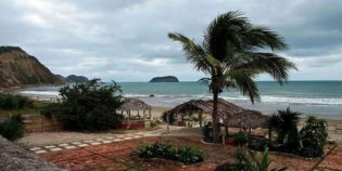
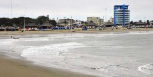
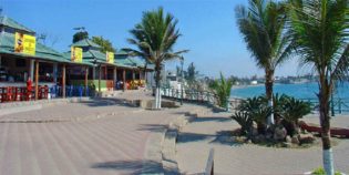
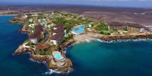
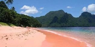
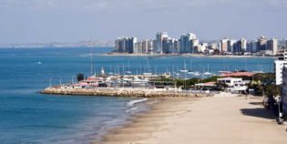
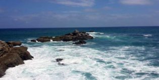
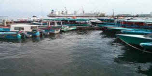
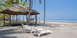
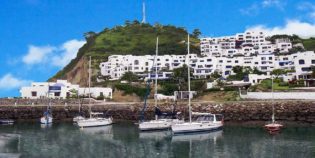
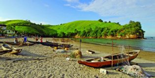
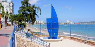
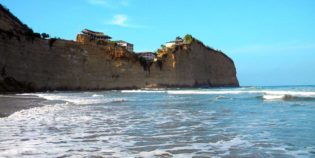
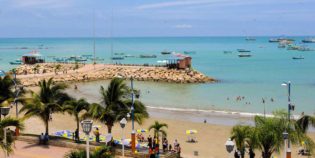
The region of the Ecuadorian Pacific coast is known by locals simply as Costa. This region consists of the western low portion of the Equator. It extends from the Pacific Ocean to the foothills of the Andes Mountains. The coast has beautiful beaches and tons of beautiful beach communities. One thing you have to do is walk along the coast of Ecuador. Do not forget to follow the Spondylus Route! - formerly known as Ruta del Sol!

The climate in the Costa region is generally very hot to hot. The rainy season goes from December to May. The dry season runs from June to November. The climate is less humid but still a bit humid.

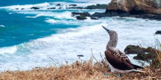
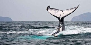
This is a complete guide to the Pacific coast of Ecuador. Learn more about its incredible beaches, colonial cities, national parks, and wildlife.

Facts & Information

Language: Spanish
Currency: US Dollar

Location: South America
Country: Ecuador

Main Destinations: Guayaquil, Machalilla National Park, Salinas, and Montañita

Provinces: El Oro, Esmeraldas, Guayas, Los Ríos, Manabí, Santa Elena, Santo Domingo.

Average temperature: 76º-90ºF (25º-33ºC)
Weather / Climate

Recommended places to visit / Day trips
Cities & towns to go

Need more information to plan your trip to Ecuador? Click here to see more resources on how to prepare your trip.
The Ecuadorian Pacific Coast region not only has beautiful beaches and wonderful nature. It is also rich with many traditional festivities. Here you will find some interesting festivals celebrated in their five provinces: El Oro, Esmeraldas, Guayas, Los Ríos, Manabí, ...
Find out what the best destinations in the Ecuadorian Coast are. Most top tourist destinations have good driving routes. Enjoy beautiful beaches and turquoise waters that line its shores. Here, the possibilities for adventure are endless.
Want to visit Guayaquil, Ecuador? Biggest port, economic capital, and Ecuador's largest city. During its festivities, Guayaquil is full of energy, style and an inherent love that is shown in its festivals full of dance, parades and typical food. Below is ...

Looking for more travel maps? Click here to see more Ecuador travel maps
Here find a tourist map of humpback whale watching in the Pacific Coast of Ecuador. This event can be observed in the provinces of Guayas, Manabi, and Esmeraldas. Need more information about traveling to Ecuador? Click here to see more ...
Here find a tourist map of humpback whale watching in Manabí, Ecuador. Every year, around the months of June to September, humpback whales make their way from Antarctica to the waters of Ecuador. Need more information about traveling to Ecuador? ...
Here find a tourist map of the Los Ríos province of Ecuador. Babahoyo and its surrounding towns and attractions. Need more information about traveling to Ecuador? Click here to see more Ecuador travel maps or Click here to see more resources on ...

Sightseeing / Popular things to do

Bird-watching, National Parks & Ecological Reserves
Cerro Blanco Forest is a tropical dry forest reserve in the Guayas province, Ecuador. It is located 20 minutes from the city of Guayaquil. Cerro Blanco supports more than 500
Beaches & Surfing, Bird-watching, Marine life (whales, dolphins, sea lions), National Parks & Ecological Reserves, Snorkeling & Scuba Diving, Spondylus route
Machalilla National Park is one of the largest protected areas located in Manabi, Ecuador. The park has many islands and beautiful beaches to enjoy, from June to September, humpback whales
National Parks & Ecological Reserves
Santay Island (Isla Santay in Spanish) is a recreation area located between the cities of Guayaquil and Duran, in the Guayas river. Guayaquil and the Santay Island are connected through
National Parks & Ecological Reserves
The Petrified Forest Puyango has the largest collection of petrified wood in the world. Trees are about 100 million years old. There are two ancient roads: The Araucarios and the
National Parks & Ecological Reserves
Churute Mangroves Ecological Reserve near Guayaquil. It is the largest protected area of Mangrove Forest in Ecuador. It contains approximately 50,000 hectares of mangroves and dry tropical forests. Manglares Churute is
National Parks & Ecological Reserves
Mache-Chindul Ecological Reserve protects some of the last remaining tropical dry and rain forests of the Ecuadorian coast. This natural area is a biodiversity hotspot due to the enormous variety

Volcanoes & Mountains
Guayaquil is a coastal city with no volcanoes, but Chimborazo is the closest volcano to Guayaquil. Mount Chimborazo lies some 137 m. (222 km.) west from Guayaquil. Chimborazo is the highest

Parks, Rivers, Lakes & Lagoons
Forestal Park, “Parque Forestal” in Spanish, is a park in Guayaquil, Ecuador. It has 24 acres (10 hectares) that include a forest area, a lake, a children’s playground area, a
Rivers, Lakes & Lagoons
Malecón del Salado is a linear park/boardwalk along the estuary Salado. It is a well-known place in Guayaquil, Ecuador. The area is distributed on two floors. Malecon del Salado has beautiful
Historic Buildings & Landmarks, Rivers, Lakes & Lagoons
Las Peñas neighborhood is a colorful colonial place located next to the Guayas River in Guayaquil. Located at the end of the Malecón 2000, in the Santa Ana Hill. It
Rivers, Lakes & Lagoons
Malecón 2000 is a promenade that overlooks the Guayas River. Malecón 2000 is one of the most important and visited places in the city of Guayaquil, Ecuador. Malecón 2000 is

Waterfalls & Hot springs
El Salto del Armadillo is a waterfall located in the canton of El Carmen, in the coastal province of Manabí, Ecuador. Approximately 656 ft. (200 m.) from the road that
Waterfalls & Hot springs
7 Cascadas is a group of seven waterfalls located 57 mi. (91 km.) from Guayaquil, Ecuador. This is in the Cooperativa 23 de Noviembre, a small town in the Naranjal

Beaches & Surfing
Find the best Beaches near Guayaquil. Closest beaches to Guayaquil are located West of the city, on the Pacific Coast. The nearest beach is called “Playas”, located in the town of General
Beaches & Surfing, Bird-watching, Marine life (whales, dolphins, sea lions), National Parks & Ecological Reserves, Snorkeling & Scuba Diving, Spondylus route
Machalilla National Park is one of the largest protected areas located in Manabi, Ecuador. The park has many islands and beautiful beaches to enjoy, from June to September, humpback whales
Beaches & Surfing, Marine life (whales, dolphins, sea lions), Snorkeling & Scuba Diving
Puná Island is a large island off the coast of the Gulf of Guayaquil, Ecuador. It has a protected area of 855 square km., well known for its great mangroves
Beaches & Surfing, Spondylus route
Chipipe is a beach located west of Salinas Yacht Club, in the province of Santa Elena, Ecuador. Chipipe is a sector relatively close to Salinas. It has a more relaxed
Beaches & Surfing, Marine life (whales, dolphins, sea lions), Spondylus route
Puerto Cayo is a fishing village located south of Manabí, Ecuador. Its beach is about 3 mi (5 km). Puerto Cayo is the closest port to the Machalilla National Park.
Beaches & Surfing, Spondylus route
General Villamil Playas is known simply as “Playas” is the closest beach to Guayaquil, Ecuador. Only 60 mi (96 km) away — an hour’s drive by car. General Villamil Playas
Beaches & Surfing, Spondylus route
Ballenita is a coastal city located in the province of Santa Elena, Ecuador. This peaceful beach is only 5 minutes from La Libertad, 20 from Salinas and 40 from Montañita.
Beaches & Surfing, Spondylus route
Ayangue is a small beach town in Ecuador. Ayangue beach is calm, water is warm with no currents, making it safe and kid-friendly. Along the beach, there are fishermen’s canoes
Beaches & Surfing
Playa Rosada or pink beach is a coastal town located in Santa Elena province, Ecuador. Playa Rosada is a tranquil, secluded, pink-sand gem. This beach keeps its virgin nature and
Beaches & Surfing
Punta Carnero is a beach on an island located in the province of Santa Elena, 10 minutes by car from Salinas, Ecuador. It is one of the best places to
Beaches & Surfing
Mar Bravo is a beach located in the province of Santa Elena, Ecuador. A few minutes from Salinas, another coastal city. Mar Bravo is inside the are of the Ecuadorian
Beaches & Surfing
Jambelí is an island surrounded by mangroves. It is located South of Ecuador. Jambelí is the closest beach to Machala. To reach Jambelí, visitors take a boat from Puerto Bolívar
Beaches & Surfing
Portete Island or “Isla Portete” is a small island located south of Esmeraldas, Ecuador. It is less than 3.7 mi (6 km) long north to south and 1.2 mi (2
Beaches & Surfing
Same beach is the north coast’s most popular beach in Esmeraldas, Ecuador. Same beach is not really a city or even a village but sector with a string of white
Beaches & Surfing, Spondylus route
Súa beach is a fishing village surrounded by hills and cliffs, located 21.7 mi (35 km) from Esmeraldas city and 3.7 mi (6 km) south of Atacames, Ecuador. Súa beach has
Beaches & Surfing, Spondylus route
Salinas is a coastal city located in the province of Santa Elena. Salinas is the main beach resort on the south coast of Ecuador. Salinas has a stretch of immaculate
Beaches & Surfing, Spondylus route
Olón is a peaceful and quiet coastal town located in Santa Elena, Ecuador. Olón has clean and tranquil beaches, great for couples or families with children. It also has a
Beaches & Surfing
La Libertad is a clean and organized coastal town located in Santa Elena, Ecuador. It is considered the largest commercial center in the Santa Elena peninsula. La Libertad has a
Beaches & Surfing, Spondylus route
Montañita is a coastal town located in Santa Elena. It is considered one of the best beaches in Ecuador. This town has a bohemian touch. Montañita is usually crowded, with
Beaches & Surfing, Marine life (whales, dolphins, sea lions), Places, Spondylus route
Manta is a coastal city located in the province of Manabí. Known as the “Tuna Capital of the World.” Manta has the largest seaport in Ecuador. It is a stopping

Bird-watching, National Parks & Ecological Reserves
Cerro Blanco Forest is a tropical dry forest reserve in the Guayas province, Ecuador. It is located 20 minutes from the city of Guayaquil. Cerro Blanco supports more than 500
Beaches & Surfing, Bird-watching, Marine life (whales, dolphins, sea lions), National Parks & Ecological Reserves, Snorkeling & Scuba Diving, Spondylus route
Machalilla National Park is one of the largest protected areas located in Manabi, Ecuador. The park has many islands and beautiful beaches to enjoy, from June to September, humpback whales
Beaches & Surfing, Bird-watching, Marine life (whales, dolphins, sea lions), Snorkeling & Scuba Diving, Spondylus route
Isla de la Plata (“Silver Island”) is an island full of natural wildlife, located 25 mi (40 km) offshore. Isla de la Plata is part of Machalilla National Park and part
Beaches & Surfing, Bird-watching, Marine life (whales, dolphins, sea lions), Spondylus route
Puerto López is a small fishing village, located in the center of the Machalilla National Park, in the province of Manabí, Ecuador. Puerto López is located in a wide bay

Jungle Towns & Rainforest
Jungle towns and rainforests are found in the Amazon Basil. Nearest jungle towns to Guayaquil can be found traveling either to the north-east or to the south-east. To the south-east,

Guayas is a coastal province in Ecuador. Located in the central area of the coast, in a region washed by ...

Guayas province location.

El Oro is a province located in the coast of Ecuador. Its capital is Machala. Oro means gold, this province ...

El Oro province location.

Esmeraldas is a province located in the northwestern Pacific coast of Ecuador, on the border with Colombia. Its capital shares ...

Esmeraldas province location.

Los Rios province is located in the foothills of the western Andes in central Ecuador. Its capital is Babahoyo. Los ...

Los Rios province location.

Manabí is a province in central coastal Ecuador. Its capital is Portoviejo, where there is a local airport. Manabí has ...

Manabi province location.

Santa Elena is a coastal Ecuadorian province. Its capital shares the same name. Santa Elena is located on an Ecuadorian ...

Santa Elena province location.

Map location / Where is it located?

The Andean Highlands is a region in the central part of Ecuador. It extends from north to south. This region is the Ecuador's most visited area. Home to the Andes Mountains, this regions is known by locals as Sierra. Ecuador's Andes consist of two mountain ranges:  Central and Western; separated by a ...

Ecuador's Andes, Sierra Region

Oriente region, also known as the Amazon, is located in the eastern Ecuador. The Oriente region occupies a massive area covering almost half the country. It extends from the eastern slopes of the Andes into the Amazon basin.

Ecuador's Amazon, Oriente Region

Galápagos Islands is a region is located about 1000 km west of the Ecuadorian coast; frequently visited by tourist to enjoy its enchanted islands. The Galapagos Islands are famous for their endemic species, their remarkable marine life, and the studies made by Charles Darwin.

Ecuador's Galapagos, Insular Region

error: Alert: Content is protected !!