Amazon Basin (Oriente Region)

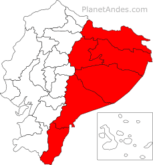
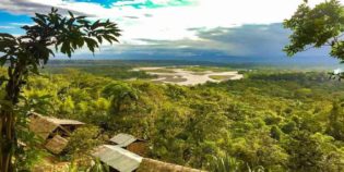
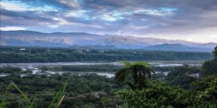
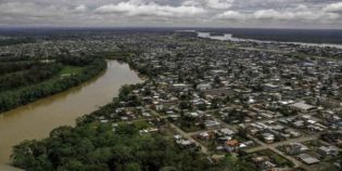
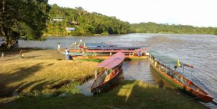
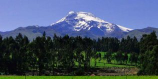
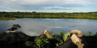
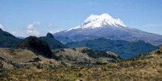
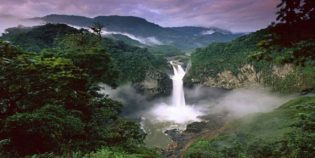
The Amazon Basin is located in eastern Ecuador. This region occupies a massive area, covering almost half the country. It extends from the eastern slopes of the Andes to the Peruvian and Colombian borders. The Amazon is known by locals as Oriente. Home to some native groups who live mostly in small villages along with the river courses. These people still maintain their traditions and customs.

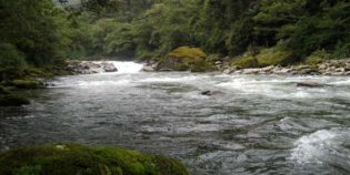
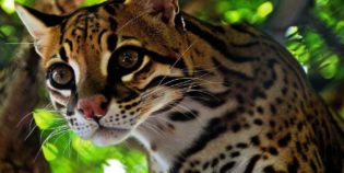
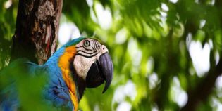
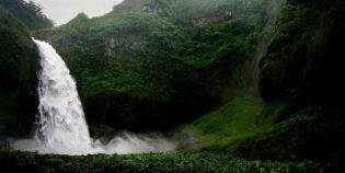
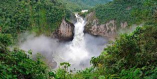
The Amazon region is one of the most biodiverse places on earth. Ecuador's Amazon has several national parks and reserves. Foreign tourists usually visit national parks to see some wildlife that lives in there, as well as to spot ethnic birds. This region is also rich in fruits and spices.  The most popular destinations are the Cuyabeno Wildlife Reserve and Yasuni National Park.

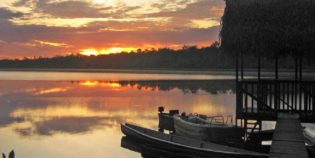
The climate in the rainforest is hot, humid and rainy. The drier season is generally from November to February.

Facts & Information

Language: Spanish
Currency: US Dollar

Location: South America
Country: Ecuador

Main Destinations: Cuyabeno Wildlife Reserve, Yasuni National Park

Provinces: Morona-Santiago, Napo, Orellana, Pastaza, Sucumbíos, Zamora-Chinchipe

Average temperature: 72º-80º F (22º-26ºC)
Weather / Climate

Recommended places to visit / Day trips
Cities & towns to go

Need more information to plan your trip to Ecuador? Click here to see more resources on how to prepare your trip.
Are you planning your next trip to the Ecuadorian Amazon rainforest? You don't know when to go? Maybe these traditional festivities will help you decide the best time to visit the Amazon jungle in the provinces of Morona Santiago, Napo, Orellana, ...
Ecuador is a treasure trove for travel. Create your own adventure with our list of the top places to visit in the Ecuadorian Amazon. On your next trip to Ecuador, visit these places to have a blissful and thrilling experience!

Looking for more travel maps? Click here to see more Ecuador travel maps
Here find a tourist map of the Imbabura volcano, located near the Otavalo town, in the Imbabura province. This is Northeast of Quito, Ecuador. Need more information about traveling to Ecuador? Click here to see more Ecuador travel maps or Click here to see ...
Here find a tourist map of Zamora-Chinchipe province of Ecuador. Zamora and its surrounding towns and attractions. Need more information about traveling to Ecuador? Click here to see more Ecuador travel maps or Click here to see more resources on how to ...

Sightseeing / Popular things to do

National Parks & Ecological Reserves
Cayambe Coca National Park is a protected area of damp forests and high grass plains. It extends throughout the provinces of Imbabura, Pichincha, Napo, and Sucumbios. Located about 24 mi.
Bird-watching, Jungle Towns & Rainforest, National Parks & Ecological Reserves
Llanganates National Park is a protected area part of the Tungurahua and Napo in Ecuador. This park has stunning lakes, rivers, mountains, and cloud forests. Llanganates means “beautiful hill”. The
Bird-watching, National Parks & Ecological Reserves
Yacuri National Park is a protected area. Located southeast of Ecuador, on the border with Peru, between the provinces of Loja and Zamora Chinchipe. The park protects moorland, cloud forests,
National Parks & Ecological Reserves, Rivers, Lakes & Lagoons
Antisana Ecological Reserve is a protected area. Located in Napo, Ecuador. About 62 mi (100 km) from Quito. The centerpiece of this nature reserve is the Antisana Volcano. Ecuador’s fourth
Jungle Towns & Rainforest, National Parks & Ecological Reserves
Podocarpus National Park is located in the provinces of Zamora Chinchipe and Loja in Ecuador. It covers an area of 1460 km2. Podocarpus has some of the greatest plant and animal
Jungle Towns & Rainforest, National Parks & Ecological Reserves, Rivers, Lakes & Lagoons
Limoncocha Biological Reserve is located in the Sucumbios province, Ecuador. This is about 229 miles east from Quito. The reserve has an area of 11,399 acres (​​4,613 hectares). One of
Bird-watching, Jungle Towns & Rainforest, Marine life (whales, dolphins, sea lions), National Parks & Ecological Reserves
Cuyabeno Wildlife Reserve is a protected area located in the Sucumbíos and Orellana provinces. It provides home and habitat for countless of plant, animal, and more than 515 species of
Bird-watching, Jungle Towns & Rainforest, Marine life (whales, dolphins, sea lions), National Parks & Ecological Reserves
Yasuni National Park is one of the most biodiverse places on the planet. It homes many species of mammals including pink river dolphins. As well as birds, reptiles, amphibians, and
Bird-watching, National Parks & Ecological Reserves
Sangay National Park is a UNESCO World Heritage Centre, located in the Morona Santiago, Chimborazo and Tungurahua provinces, Ecuador. The Sangay National Park includes three volcanoes: Tungurahua (16,457 ft –

Active Volcanoes, Volcanoes & Mountains
Sangay is the most active volcano in Ecuador with a peak elevation of 17,017 ft. (5,188 m.) height above the sea level. In fact, it is one of the highest
Active Volcanoes, Volcanoes & Mountains
Sumaco volcano is located in the isolated Sumaco Napo-Galeras National Park, in the Orellana province of Ecuador, west of Quito. Sumaco volcano soars 13,087 feet (3,990 meters) above the jungle.
Active Volcanoes, Volcanoes & Mountains
Reventador is one of Ecuador’s most active volcanoes. It has an elevation of 11,683 ft. (3,562 m.) above sea level.  The caldera is 2.5 mi. (4 km.) wide in diameter.

National Parks & Ecological Reserves, Rivers, Lakes & Lagoons
Antisana Ecological Reserve is a protected area. Located in Napo, Ecuador. About 62 mi (100 km) from Quito. The centerpiece of this nature reserve is the Antisana Volcano. Ecuador’s fourth
Jungle Towns & Rainforest, National Parks & Ecological Reserves, Rivers, Lakes & Lagoons
Limoncocha Biological Reserve is located in the Sucumbios province, Ecuador. This is about 229 miles east from Quito. The reserve has an area of 11,399 acres (​​4,613 hectares). One of

Bird-watching, Jungle Towns & Rainforest, Waterfalls & Hot springs
Rio Malo waterfall is a waterfall located in the Napo province, in the Amazon Region of Ecuador. It is part of The Cayambe-Coca Ecological Reserve. This waterfall has a fall of
Bird-watching, Jungle Towns & Rainforest, Waterfalls & Hot springs
San Rafael waterfall, in the Coca River, is one of the largest waterfalls in the eastern part of Ecuador. This waterfall has a fall of more than 492 ft. (150
Waterfalls & Hot springs
Pimpilala waterfalls are located in the community of Cando, parish Talag, southwest of the city of Tena. Tena is the capital of the Napo province, in the Amazon Region of
Bird-watching, Jungle Towns & Rainforest, Waterfalls & Hot springs
Papallacta is a small town located in the Napo province, 20 miles west from Quito. Nestled between the Cayambe and the Antisana volcanoes. The town has an elevation of 10,800 ft.

Bird-watching, Jungle Towns & Rainforest, Waterfalls & Hot springs
Rio Malo waterfall is a waterfall located in the Napo province, in the Amazon Region of Ecuador. It is part of The Cayambe-Coca Ecological Reserve. This waterfall has a fall of
Bird-watching, Jungle Towns & Rainforest, National Parks & Ecological Reserves
Llanganates National Park is a protected area part of the Tungurahua and Napo in Ecuador. This park has stunning lakes, rivers, mountains, and cloud forests. Llanganates means “beautiful hill”. The
Bird-watching, National Parks & Ecological Reserves
Yacuri National Park is a protected area. Located southeast of Ecuador, on the border with Peru, between the provinces of Loja and Zamora Chinchipe. The park protects moorland, cloud forests,
Bird-watching, Jungle Towns & Rainforest, Waterfalls & Hot springs
San Rafael waterfall, in the Coca River, is one of the largest waterfalls in the eastern part of Ecuador. This waterfall has a fall of more than 492 ft. (150
Bird-watching, Jungle Towns & Rainforest, Waterfalls & Hot springs
Papallacta is a small town located in the Napo province, 20 miles west from Quito. Nestled between the Cayambe and the Antisana volcanoes. The town has an elevation of 10,800 ft.
Bird-watching, Jungle Towns & Rainforest, Marine life (whales, dolphins, sea lions), National Parks & Ecological Reserves
Cuyabeno Wildlife Reserve is a protected area located in the Sucumbíos and Orellana provinces. It provides home and habitat for countless of plant, animal, and more than 515 species of
Bird-watching, Jungle Towns & Rainforest, Marine life (whales, dolphins, sea lions), National Parks & Ecological Reserves
Yasuni National Park is one of the most biodiverse places on the planet. It homes many species of mammals including pink river dolphins. As well as birds, reptiles, amphibians, and
Bird-watching, National Parks & Ecological Reserves
Sangay National Park is a UNESCO World Heritage Centre, located in the Morona Santiago, Chimborazo and Tungurahua provinces, Ecuador. The Sangay National Park includes three volcanoes: Tungurahua (16,457 ft –

Bird-watching, Jungle Towns & Rainforest, Waterfalls & Hot springs
Rio Malo waterfall is a waterfall located in the Napo province, in the Amazon Region of Ecuador. It is part of The Cayambe-Coca Ecological Reserve. This waterfall has a fall of
Bird-watching, Jungle Towns & Rainforest, National Parks & Ecological Reserves
Llanganates National Park is a protected area part of the Tungurahua and Napo in Ecuador. This park has stunning lakes, rivers, mountains, and cloud forests. Llanganates means “beautiful hill”. The
Jungle Towns & Rainforest, Places
Tena is a peaceful town, capital of the Napo province, Ecuador. Tena is also known as “Cinnamon Capital” — “Capital de la Canela” in Spanish. “Canela” means “cinnamon” — Tena
Jungle Towns & Rainforest, Places
Puerto Francisco de Orellana, also known as “Coca.” Coca is the capital of the Orellana province, Ecuador. Puerto Francisco de Orellana is situated at the junction of the Coca, Payamino,
Jungle Towns & Rainforest, Places
Puyo is the capital of the Pastaza province. Located only 20 mi. (32 km.) from the town of Baños de Agua Santa and 4 1/2 hours bus ride from Quito
Bird-watching, Jungle Towns & Rainforest, Waterfalls & Hot springs
San Rafael waterfall, in the Coca River, is one of the largest waterfalls in the eastern part of Ecuador. This waterfall has a fall of more than 492 ft. (150
Jungle Towns & Rainforest, National Parks & Ecological Reserves
Podocarpus National Park is located in the provinces of Zamora Chinchipe and Loja in Ecuador. It covers an area of 1460 km2. Podocarpus has some of the greatest plant and animal
Jungle Towns & Rainforest, National Parks & Ecological Reserves, Rivers, Lakes & Lagoons
Limoncocha Biological Reserve is located in the Sucumbios province, Ecuador. This is about 229 miles east from Quito. The reserve has an area of 11,399 acres (​​4,613 hectares). One of
Bird-watching, Jungle Towns & Rainforest, Waterfalls & Hot springs
Papallacta is a small town located in the Napo province, 20 miles west from Quito. Nestled between the Cayambe and the Antisana volcanoes. The town has an elevation of 10,800 ft.
Bird-watching, Jungle Towns & Rainforest, Marine life (whales, dolphins, sea lions), National Parks & Ecological Reserves
Cuyabeno Wildlife Reserve is a protected area located in the Sucumbíos and Orellana provinces. It provides home and habitat for countless of plant, animal, and more than 515 species of
Bird-watching, Jungle Towns & Rainforest, Marine life (whales, dolphins, sea lions), National Parks & Ecological Reserves
Yasuni National Park is one of the most biodiverse places on the planet. It homes many species of mammals including pink river dolphins. As well as birds, reptiles, amphibians, and
Jungle Towns & Rainforest, Places
Macas is a small town, capital of Morona Santiago, Ecuador. It is known as the “Emerald of the East” due to its location east of the Andes mountains. Macas lies

Morona Santiago is a province in Ecuador. Macas is its capital. The province was established on February 24, 1954. Morona Santiago ...

Morona Santiago province location.

Napo is a province located in the Ecuadorian Oriente, five hours bus ride from Quito. Its capital is Tena. Napo's ...

Napo province location.

Orellana is a province of Ecuador. Its capital is Puerto Francisco de Orellana known as “Coca”. This province is surrounded ...

Orellana province location.

Pastaza is a province located in the Oriente of Ecuador. Its capital is Puyo. Its territory is mostly covered by ...

Pastaza province location.

Sucumbíos is an Ecuadorian province. Its capital is Nueva Loja; also known as Lago Agrio. This province is famous for ...

Sucumbios province location.

Zamora Chinchipe is an Ecuadorian province. Its capital is Zamora. This province is located at the southeastern end of the ...

Zamora Chinchipe province location.

Map location / Where is it located?

The Andean Highlands is a region in the central part of Ecuador. It extends from north to south. This region is the Ecuador's most visited area. Home to the Andes Mountains, this regions is known by locals as Sierra. Ecuador's Andes consist of two mountain ranges:  Central and Western; separated by a ...

Ecuador's Andes, Sierra Region

Pacific Coast consists of the low lying western portion of Ecuador. It extends from the Pacific coastline to the foothills of the Andes Mountains that lie to the east. This region has many beautiful beaches and small coastal communities.

Ecuador's Coast, Costa Region

Galápagos Islands is a region is located about 1000 km west of the Ecuadorian coast; frequently visited by tourist to enjoy its enchanted islands. The Galapagos Islands are famous for their endemic species, their remarkable marine life, and the studies made by Charles Darwin.

Ecuador's Galapagos, Insular Region

error: Alert: Content is protected !!