Andean Highlands (Sierra Region)

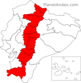
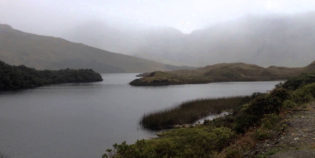
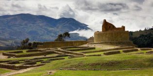
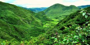
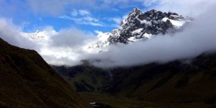
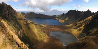
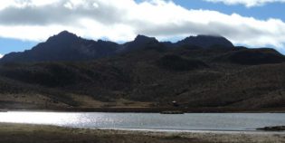
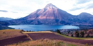
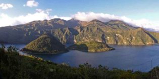
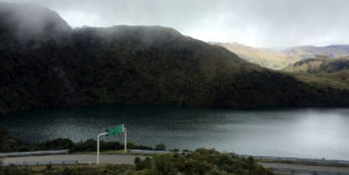
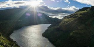
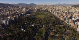
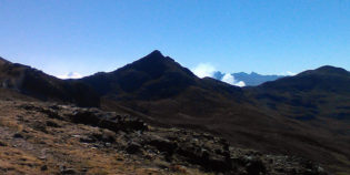
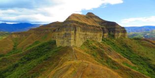
The Andean Highlands or the Andes is a region in the central part of Ecuador. It extends from north to south. This region is Ecuador's most visited area. Home to the Andes Mountains, this region is known by locals as Sierra. Ecuador's Andes consist of two mountain ranges:  Central and Western; separated by a narrow central valley.

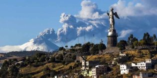
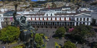
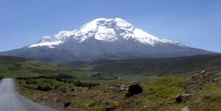
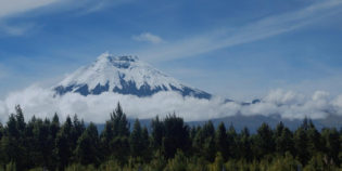
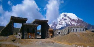
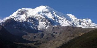
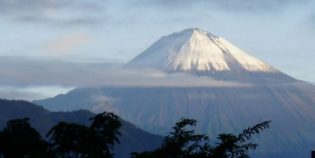
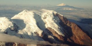
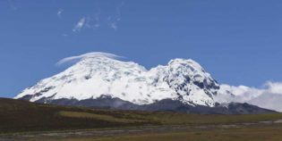
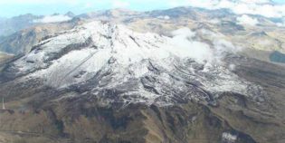
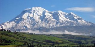
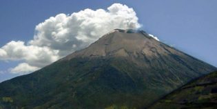
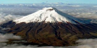
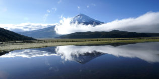
Among the main destinations are Quito, Mindo, Baños, and Riobamba. While, most popular volcanoes are Cotopaxi, Pichincha, and Chimborazo. Another point of interest is the Avenue of Volcanoes which consists of a large number of volcanoes some of which are still active, while others only show their remains.

The climate varies according to the altitude and time of year. The drier season is generally from November to February. The weather is usually fairly consistent. Plenty of sun in the mornings, and frequent rain in the afternoon.

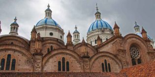
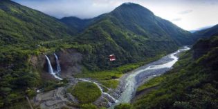
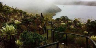
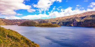
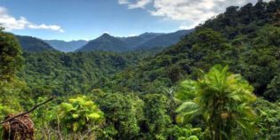
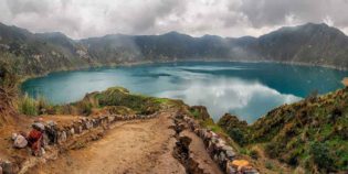
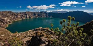
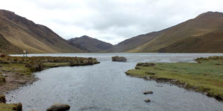
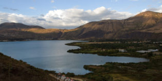
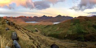
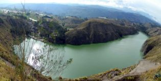
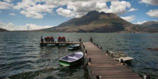
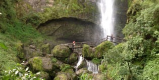
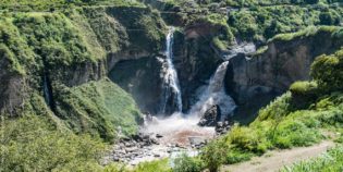
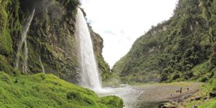
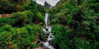
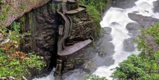
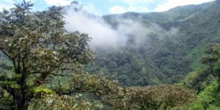
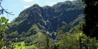
This is a complete guide of Ecuador's Andes. Learn more about its panoramic views, snow-capped peaks, high altitude wetlands, and cloud forest. As well as its colonial towns, hot springs, national parks, and wildlife.

Facts & Information

Language: Spanish
Currency: US Dollar

Location: South America
Country: Ecuador

Main Destinations: Quito, Cuenca, Riobamba

Provinces: Azuay, Bolivar, Cañar, Carchi, Chimborazo, Cotopaxi, Imbabura, Loja, Pichincha, Tungurahua.

Average temperature: 55º-78º F (12º-25ºC)
Weather / Climate

Recommended places to visit / Day trips
Cities & towns to go

Need more information to plan your trip to Ecuador? Click here to see more resources on how to prepare your trip.
The best way to explore The Ecuadorian Andes region and learn about their history and culture is to join their festivals! Here are the major holidays celebrated in the provinces of Azuay, Bolívar, Cañar, Chimborazo, Imbabura, Loja, Pichincha, Santo Domingo, ...
There are so many amazing places in the Ecuadorian Andes to see, the central countryside offers picturesque towns and villages.  Scroll down below to see our picks of the most beautiful places to visit in the Andes Mountains of Ecuador. These beautiful ...
Are you looking for facts about Quito, Ecuador? Then you've come to the right place! Here's a list of 20 Interesting facts and some information about Quito. 1. What is Quito's full name? The official name of Quito is San Francisco de Quito. ...

Looking for more travel maps? Click here to see more Ecuador travel maps
Here find a tourist map of Cotacachi-Cayapas National Park in Ecuador. The reserve extends from Imbabura in the Andes, to the coastal province of Esmeraldas. Need more information about traveling to Ecuador? Click here to see more Ecuador travel maps or Click ...
Here find a tourist map of the Cañar province of Ecuador. Azogues and its surrounding towns and attractions. Need more information about traveling to Ecuador? Click here to see more Ecuador travel maps or Click here to see more resources on how ...

Sightseeing / Popular things to do

National Parks & Ecological Reserves
El Arenal desert is a region of the Bolívar province in Ecuador. Located in the limit with the Chimborazo province, in the road Guaranda-Ambato. El Arenal is the dry western side
National Parks & Ecological Reserves
Ingapirca Inca Ruins are the best-preserved ruins in Ecuador. Ingapirca means “Inka Pirka” in Quechua (Wall of the Inca). This archaeological discovery protects the memory of the Incas that once walked
Bird-watching, National Parks & Ecological Reserves, Rivers, Lakes & Lagoons
El Angel Ecological Reserve is a unique area in the Carchi province of Ecuador. In the border with Colombia. The closest city is Tulcan. About 3 hours from Quito. This reserve
Bird-watching, National Parks & Ecological Reserves, Rivers, Lakes & Lagoons
Cajas National Park is located about 30 km west from Cuenca. Due to the altitude – 3,156 to 4,450 meters above sea level – it is really chilly in the
Bird-watching, National Parks & Ecological Reserves, Rivers, Lakes & Lagoons
Cotacachi-Cayapas Ecological Reserve contains 752,235 acres (304418 hectares) of land. It extends from Imbabura – in the Ecuadorian Andes mountains to the western edge of the rainforest in the Esmeraldas. The
Bird-watching, National Parks & Ecological Reserves, Rivers, Lakes & Lagoons
Mindo-Nambillo Ecological Reserve is located two hours north of Quito, Ecuador. Its main feature is the Mindo-Nambillo Cloud Forest. Mindo-Nambillo biodiversity allows more than 350 bird species to live in
Bird-watching, National Parks & Ecological Reserves
Pululahua Geobotanical Reserve is a calm and isolated volcanic crater. This protected area is inside the Pululahua volcano. It is rich with a great diversity of fauna and flora. “Reserva
National Parks & Ecological Reserves
Ilinizas Ecological Reserve, also known as Ilinizas National Park, is a protected area located between Cotopaxi and Pichincha provinces. 55km south of Quito and extends through the Quilotoa Loop area. The
National Parks & Ecological Reserves
Cotopaxi National Park is located in the Cotopaxi Province, around 50 km south of Quito. The Cotopaxi volcano – 19,347 feet (5,897 m) – is the main attraction of this
Bird-watching, National Parks & Ecological Reserves
Chimborazo Fauna Reserve is located in the provinces of Chimborazo, Tungurahua, and Bolivar in the Ecuadorian Andes. The reserve is a protected area that guards a wide variety of vegetation

Volcanoes & Mountains
Mount Carihuairazo is a volcanic caldera, in a beautiful snow-topped mountain. Located inside the Chimborazo Fauna Reserve. Close to the Chimborazo volcano — Ecuador’s highest mountain. The nearest city is
Volcanoes & Mountains
Chimborazo volcano is the closest one to Riobamba. West of Riobamba is El Altar, an inactive volcano, and Tungurahua volcano. Going south there is the Sangay volcano, the least accessible
Volcanoes & Mountains
There are no volcanoes in Cuenca, Ecuador. Sangay volcano is the closest one, it is located in the Morona Santiago province, part of the Sangay National Reserve. The Sangay volcano is
Volcanoes & Mountains
Pichincha volcano is the closest one to Quito. The nearest accessible point to the Rucu Pichincha is the top of the Teleférico de Quito, from there you can walk. The
Active Volcanoes, Volcanoes & Mountains
Cayambe volcano is a snow-capped volcano with an altitude of 18,996 ft. (5,790 m.) above sea level. Located 37 mi. (60 km.) Northeast of Quito. Cayambe volcano is part of
Active Volcanoes, Bird-watching, Volcanoes & Mountains
Antisana is an impressive and beautiful double cone volcano. The Antisana volcano is located inside the Antisana Ecological Reserve, between the provinces of Napo and Pichincha. This is about 31
Volcanoes & Mountains
Chiles volcano is a snowcapped volcano located on the border of Ecuador and Colombia. It has about 4760 meters height, climbing this volcano is a challenge for people seeking a
Rivers, Lakes & Lagoons, Volcanoes & Mountains
El Altar is an extinct volcano on Sangay National Park. 170 km south of Quito, near Riobamba. It has nine peaks surrounding a beautiful glacial crater lake. Surrounding the crater,
Volcanoes & Mountains
Chimborazo volcano is the highest peak of Ecuador. It is 20,564 feet (6,268 meters) height. The mountain is capped with eternal snow. Chimborazo volcano is the farthest point from the center
Rivers, Lakes & Lagoons, Volcanoes & Mountains
Quilotoa is an inactive volcano. It features an awe-inspiring volcanic crater lake. Surrounded by massive sheer cliffs and filled with deep blue and turquoise water. Quilotoa sits in the center
Rivers, Lakes & Lagoons, Volcanoes & Mountains
Mojanda lakes are three turquoise lagoons nestled in the Andes Highlands. They are amongst once-active volcanoes. Located in the Imbabura province, near Otavalo. “Lagunas de Mojanda” in Spanish. It has
Active Volcanoes, Volcanoes & Mountains
Tungurahua is an active volcano with an elevation of 16,475 ft. (5,023 m.) above sea level. It is an impressive symmetric volcano, but its summit is usually under clouds. Located in
Active Volcanoes, Volcanoes & Mountains
The Pichincha volcano is an active stratovolcano located next to the city of Quito, capital of Ecuador. The three highest peaks of the Pichincha volcano, known as “Los Pichinchas” are
Volcanoes & Mountains
The Illinizas are a pair of volcanic mountains, their peaks are covered with glaciers. Located 55 km (34 mi) south of Quito, Ecuador. The Illinizas used to be a complete
Volcanoes & Mountains
Imbabura is an inactive volcano with a peak elevation of 14,952 ft. (4,557 m.) height above the sea level. It has two main summits. One of the 100 m. higher
Rivers, Lakes & Lagoons, Volcanoes & Mountains
Quilotoa Lake set in its deep volcanic crater is an extraordinary landscape, visitors can hike around the crater’s rim, visit on mules or kayak across the turquoise waters. Quilotoa lake is
Active Volcanoes, Volcanoes & Mountains
Cotopaxi volcano is the best-known active volcano of Ecuador. Also, one of the most famous in South America. Located in the Cotopaxi province, about 31 mi. (50 km.) South of
Rivers, Lakes & Lagoons, Volcanoes & Mountains
Cuicocha is a caldera nestled within the crater of the Cotacachi volcano. It has an elevation of 10,649 ft. (3,246 m.) Located in the Imbabura province, in Ecuador. “Laguna Cuicocha”

Rivers, Lakes & Lagoons
Culebrillas Lake is one of the landmarks of the Inca Trail – The Inca Trail is by one of the most famous treks in Ecuador. In fact, it is a popular
Rivers, Lakes & Lagoons
Laguna Amarilla is a crater-lagoon at the base of El Altar volcano, in Ecuador. El Altar has an elevation of 17,451 ft. (5,319 m.) and it is part of the
Rivers, Lakes & Lagoons
Yahuarcocha is a lake located 1.86 mi. (3 km.) Northern of Ibarra, Ecuador. Surrounded by natural viewpoints and an environment of indigenous crops and land. “Laguna Yahuarcocha” in Spanish. It
Rivers, Lakes & Lagoons
Atillo Lagoons are part of the Sangay National Park and the Ozogoche lake complex. “Lagunas de Atillo” in Spanish.  It includes several lagoons such as Negra, Cuyug, and Atillo. Located south of
Rivers, Lakes & Lagoons
Secas Lagoon, “Laguna de Secas” in Spanish, is a lagoon located in the Pichincha province, Ecuador. The closest town is Pintag. Secas lagoon was formed when the Antisana volcano erupted
Rivers, Lakes & Lagoons
Limpiopungo Lagoon is a beautiful lake formed by water from the glaciers. It is located very close to the Cotopaxi volcano. Limpiopungo lagoon is like a mirror that reflects the
Parks, Rivers, Lakes & Lagoons
Guayaquil Park, “Parque Guayaquil” in Spanish, is one of the parks of Riobamba, Ecuador. This interesting park has educational aspects, visitors enjoy walking around learning about local flora and fauna.
Rivers, Lakes & Lagoons
Lakes of Ozogoche — “Lagunas de Ozogoche” in Spanish — are located in the Chimborazo province of Ecuador. The Ozogoche Lakes consists of 45 separate lakes and lagoons located inside the
Parks, Rivers, Lakes & Lagoons
Parque El Ejido is a park located along Avenue Patria in the Old Centre part of Quito, Ecuador. The park could be considered as the division line between the old
Parks, Rivers, Lakes & Lagoons
Parque La Carolina is the largest park in Quito, Ecuador. Known as “La Carolina.” It is located in the center of Quito central business district. La Carolina park is a great
Rivers, Lakes & Lagoons
Green Lagoons – “Lagunas Verdes” in Spanish – are located in the Carchi province, Ecuador. This is at the southwest of the Chiles volcano. The green lagoons are three small
Bird-watching, National Parks & Ecological Reserves, Rivers, Lakes & Lagoons
El Angel Ecological Reserve is a unique area in the Carchi province of Ecuador. In the border with Colombia. The closest city is Tulcan. About 3 hours from Quito. This reserve
Bird-watching, National Parks & Ecological Reserves, Rivers, Lakes & Lagoons
Cajas National Park is located about 30 km west from Cuenca. Due to the altitude – 3,156 to 4,450 meters above sea level – it is really chilly in the
Rivers, Lakes & Lagoons, Volcanoes & Mountains
El Altar is an extinct volcano on Sangay National Park. 170 km south of Quito, near Riobamba. It has nine peaks surrounding a beautiful glacial crater lake. Surrounding the crater,
Bird-watching, National Parks & Ecological Reserves, Rivers, Lakes & Lagoons
Cotacachi-Cayapas Ecological Reserve contains 752,235 acres (304418 hectares) of land. It extends from Imbabura – in the Ecuadorian Andes mountains to the western edge of the rainforest in the Esmeraldas. The
Rivers, Lakes & Lagoons, Volcanoes & Mountains
Quilotoa is an inactive volcano. It features an awe-inspiring volcanic crater lake. Surrounded by massive sheer cliffs and filled with deep blue and turquoise water. Quilotoa sits in the center
Rivers, Lakes & Lagoons, Volcanoes & Mountains
Mojanda lakes are three turquoise lagoons nestled in the Andes Highlands. They are amongst once-active volcanoes. Located in the Imbabura province, near Otavalo. “Lagunas de Mojanda” in Spanish. It has
Bird-watching, Rivers, Lakes & Lagoons
San Pablo a lake formed by the water discharged by the waterfall Peguche. Located right at the foot of Imbabura volcano. 2.5 mi. (4 km.) west of  Otavalo, Ecuador. During the Yamor
Bird-watching, National Parks & Ecological Reserves, Rivers, Lakes & Lagoons
Mindo-Nambillo Ecological Reserve is located two hours north of Quito, Ecuador. Its main feature is the Mindo-Nambillo Cloud Forest. Mindo-Nambillo biodiversity allows more than 350 bird species to live in

Waterfalls & Hot springs
El Chorro waterfall or Girón waterfall is a beautiful waterfall with a double fall and approximately 230 ft. (70 m.) high. Located 3 mi. (5 km.) from the Girón canton,
Waterfalls & Hot springs
Termas de la Virgen is a hot springs complex, located in the middle of the town of Baños de Agua Santa, Ecuador. This hot spring pool complex is located under the
Waterfalls & Hot springs
Agoyán waterfall is the tallest waterfall of the Ecuadorian Andes. It has 132 ft. (40 m.)  of height. It is located in the Tungurahua province. Approximately 4.3 mi. (7 km.) from the city of Baños de Agua
Waterfalls & Hot springs
Condor-Machay is a waterfall located in the town of Rumipamba. This is 17 km. from Quito, Ecuador. Condor-Machay means “Nest of the Condor” in the Quichua language.  The hike to the Condor-Machay waterfall
Jungle Towns & Rainforest, Waterfalls & Hot springs
Protected Forest of Peguche is one of the most beautiful rainforests in northern Ecuador. This forest has a big area for camping and picnics. As well as a well-maintained trail
Waterfalls & Hot springs
Peguche waterfall is one of the main attractions in Otavalo and its surroundings. Located 1.86 mi. (3 km.) North of Otavalo and 14 mi. (23 km.) South of Ibarra. “Cascadas
Waterfalls & Hot springs
Bucay is a small town located in the province of Chimborazo, Ecuador. This is around a 90-minute drive east of Guayaquil. Bucay is a place full of nature. It has

Beaches & Surfing
Riobamba is located in the heart of Ecuador. Closest beaches to Riobamba are located on the Pacific Coast. The nearest beach is known as “Playas”, its full name is General
Beaches & Surfing
Quito is the capital of Ecuador. It is an incredible destination to visit, full of history and natural wonders very close to the city, but it has no beaches.  The
Beaches & Surfing
Cuenca, Ecuador is a great town, except for one thing; it’s not on the water. Closest beaches to Cuenca are located on the Pacific Coast. The nearest beach is Jambeli island,

Bird-watching
Achupallas is part of the Alausí canton, in the province of Chimborazo, Ecuador. Achupallas is a peaceful city famous for the Inca trail. The trail crosses the Tres Cruces sector,
Active Volcanoes, Bird-watching, Volcanoes & Mountains
Antisana is an impressive and beautiful double cone volcano. The Antisana volcano is located inside the Antisana Ecological Reserve, between the provinces of Napo and Pichincha. This is about 31
Bird-watching, National Parks & Ecological Reserves, Rivers, Lakes & Lagoons
El Angel Ecological Reserve is a unique area in the Carchi province of Ecuador. In the border with Colombia. The closest city is Tulcan. About 3 hours from Quito. This reserve
Bird-watching
Yunguilla Valley is a warm valley. It is full of fruit trees as mangoes, oranges, bananas, avocados, and lemons. Located 14 mi. (22km.) South West of Cuenca, in the province
Bird-watching, National Parks & Ecological Reserves, Rivers, Lakes & Lagoons
Cajas National Park is located about 30 km west from Cuenca. Due to the altitude – 3,156 to 4,450 meters above sea level – it is really chilly in the
Bird-watching, National Parks & Ecological Reserves, Rivers, Lakes & Lagoons
Cotacachi-Cayapas Ecological Reserve contains 752,235 acres (304418 hectares) of land. It extends from Imbabura – in the Ecuadorian Andes mountains to the western edge of the rainforest in the Esmeraldas. The
Bird-watching, Rivers, Lakes & Lagoons
San Pablo a lake formed by the water discharged by the waterfall Peguche. Located right at the foot of Imbabura volcano. 2.5 mi. (4 km.) west of  Otavalo, Ecuador. During the Yamor
Bird-watching, National Parks & Ecological Reserves, Rivers, Lakes & Lagoons
Mindo-Nambillo Ecological Reserve is located two hours north of Quito, Ecuador. Its main feature is the Mindo-Nambillo Cloud Forest. Mindo-Nambillo biodiversity allows more than 350 bird species to live in
Bird-watching
Vilcabamba is a peaceful town, surrounded by mountains, located 28 mi (45 km) from the city of Loja, Ecuador. It offers stunning panoramic views. Vilcabamba is a popular destination for
Bird-watching, National Parks & Ecological Reserves
Pululahua Geobotanical Reserve is a calm and isolated volcanic crater. This protected area is inside the Pululahua volcano. It is rich with a great diversity of fauna and flora. “Reserva
Bird-watching, National Parks & Ecological Reserves
Chimborazo Fauna Reserve is located in the provinces of Chimborazo, Tungurahua, and Bolivar in the Ecuadorian Andes. The reserve is a protected area that guards a wide variety of vegetation

Jungle Towns & Rainforest, Waterfalls & Hot springs
Protected Forest of Peguche is one of the most beautiful rainforests in northern Ecuador. This forest has a big area for camping and picnics. As well as a well-maintained trail
Jungle Towns & Rainforest
Visiting the Amazon from Cuenca, Ecuador is a must, nearest Amazon rainforest to Cuenca is the Podocarpus National Park, located in the provinces of Zamora Chinchipe and Loja, this is
Jungle Towns & Rainforest
Jungle towns and rainforests are found in the Amazon Basil. Nearest jungle town to Riobamba is Puyo, located in the Pastaza province, in the north-east of Ecuador. From there, you can
Jungle Towns & Rainforest
Nearest Amazon rainforest to Quito is the Cuyabeno Wildlife Reserve, located in the Orellana province, in the north-east of Ecuador. Jungle towns and rainforests are found in the Amazon Basil.

Chimborazo is a province located in the central Andes of Ecuador. Riobamba is its capital. Its main attractions are the ...

Chimborazo province location.

Azuay is a province located in the south center of Ecuador, in the highlands. It has protected areas such as ...

Azuay province location.

Bolivar province is located in the highlands of Ecuador. Its capital is Guaranda. Bolivar's main economic activities include the production ...

Bolivar province location.

Cañar is an Ecuadorian province rich in cultural traditions. Its capital is Azogues. Cañar is the ancestral home of the indigenous Cañari people ...

Cañar province location.

Carchi is a province located in the Andean highlands of Ecuador. This province is situated north of the country on ...

Carchi province location.

Cotopaxi is a province located about 45 km south of Quito. Its capital is Latacunga. This province owns majestic landscapes ...

Cotopaxi province location.

Imbabura is an Ecuadorian province with beautiful landscapes. Known as the "province of lakes". Because it has many lakes and ...

Imbabura province location.

Loja is a province in the south of Ecuador. Its capital, also named Loja, is a beautiful place to visit. ...

Loja province location.

Pichincha is one of the most visited provinces of Ecuador. Surrounded by the slopes of the Pichincha volcano (hence its ...

Pichincha province location.

Tungurahua is an Ecuadorian province. Ambato is its capital. Tungurahua volcano is one of its main attractions. Other attraction is ...

Tungurahua province location.

Map location / Where is it located?

Oriente region, also known as the Amazon, is located in the eastern Ecuador. The Oriente region occupies a massive area covering almost half the country. It extends from the eastern slopes of the Andes into the Amazon basin.

Ecuador's Amazon, Oriente Region

Pacific Coast consists of the low lying western portion of Ecuador. It extends from the Pacific coastline to the foothills of the Andes Mountains that lie to the east. This region has many beautiful beaches and small coastal communities.

Ecuador's Coast, Costa Region

Galápagos Islands is a region is located about 1000 km west of the Ecuadorian coast; frequently visited by tourist to enjoy its enchanted islands. The Galapagos Islands are famous for their endemic species, their remarkable marine life, and the studies made by Charles Darwin.

Ecuador's Galapagos, Insular Region

error: Alert: Content is protected !!