Pumapungo Museum
Main entrance. Pumapungo Museum, Cuenca

Pumapungo Museum in Cuenca is a great place to learn about the history of Ecuador from pre-colonial to the present day. In the back of the museum, there is a nice garden as well as some ancient indigenous ruins. The entrance to the Pumapungo museum is free. It is a great way to spend a ... Read more

Mirador de Turi – Lookout Point
Turi lookoup point, Cuenca

Mirador de Turi is the perfect observation place to have a panoramic view of Cuenca, Ecuador. El Mirador de Turi is a great place for stunning photos of the city. It also has a swing that attracts visitors for the thrill of swinging on the edge of a mountain. Upon reaching the Turi viewpoint, you ... Read more

previous arrow
next arrow
Slider

Azuay province

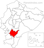
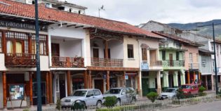
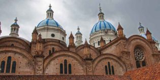
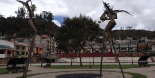
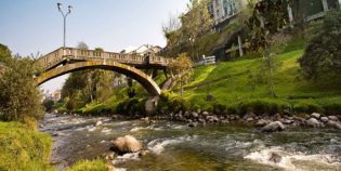
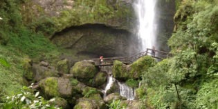
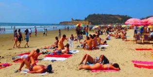
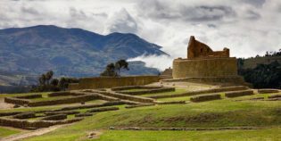
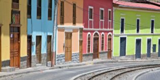
Azuay is a province located in the south center of Ecuador, in the highlands. It has protected areas such as El Cajas National Park, and Cuenca (capital), both of them are World Heritage Sites. Azuay is one of the main tourist destinations in Ecuador. Due to its beautiful towns, rich with architectural beauty and historical centers. The main destinations are El Cajas, Cuenca, Gualaceo, and Chordelec.

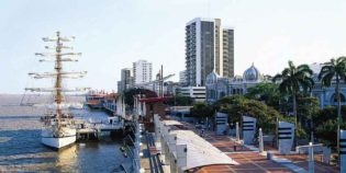
Azuay is a center of high-quality handicrafts such as weaving, embroidery, and pottery. Also, it is the home of Montecristi and Cuenca. Both cities are the primary centers of Panama hat production and export in Ecuador. In addition, many people work with artisan metals. In fact, there are foundry workshops to make lamps, supports, rails, lattices, and more. Pieces that use a lot of iron, copper, and bronze. On the other hand, this province has the most important hydroelectric power station in Ecuador — Daule Peripa Dam.

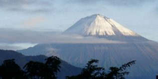
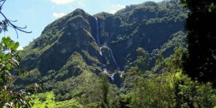
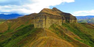
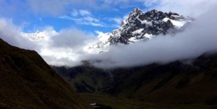
The climate varies depending on the height of the place. Azuay does not have very high mountains. In general, the mountains have a height of fewer than 13,123 ft. (4,000 m.). Weather in different places may be chilly, while in others can be chili. Temperature ranges from 50° F to 82° F (10° C to 28° C).

Azuay mayor holidays are Foundation of Cuenca on April 12 and Independence of Cuenca on November 3.

Click here to see tourist attractions map of (Cuenca) Azuay, Ecuador

Facts & Information

Language: Spanish
Currency: US Dollar

Location: South America
Country:Ecuador
Region: Andes
Capital: Cuenca

Dial code:+593 7
Time zone: UTC-5
Elevation: 8,400 ft (2,560 m)

Holidays: See festivals here

Temperature: 50°-82° F (10°-28° C)
Weather / Climate

Top tourist attractions to see
Points of Interest & landmarks

Best places to visit
Tourist destinations / Cities & towns to go

Chordeleg is a town in the Azuay province of Ecuador. Located approximately 24 mi. (40 km.) from Cuenca. Many local people produce silver, nickel, and brass jewelry. In fact, its ...
Cuenca is a beautiful historical city, capital of the Azuay province, and a UNESCO World Heritage Site. This city is famous for its stunning architecture, tourist attractions, hotels, cafes, galleries, and night activities.
Gualaceo town is located in the Azuay province, close to Cuenca. This town retains its colonial architectural elements, has a beautiful historic district that is filled with markets, parks, squares, ...
Sígsig is a town located in the Azuay province, 90 minutes East from the city of Cuenca, Ecuador. Sigsig sits in a valley surrounded by steep mountains. This town has ...

Sightseeing / Day trips
Popular things to do

Bird-watching, National Parks & Ecological Reserves, Rivers, Lakes & Lagoons
Cajas National Park is located about 30 km west from Cuenca. Due to the altitude – 3,156 to 4,450 meters above sea level – it is really chilly in the

Volcanoes & Mountains
There are no volcanoes in Cuenca, Ecuador. Sangay volcano is the closest one, it is located in the Morona Santiago province, part of the Sangay National Reserve. The Sangay volcano is

Bird-watching, National Parks & Ecological Reserves, Rivers, Lakes & Lagoons
Cajas National Park is located about 30 km west from Cuenca. Due to the altitude – 3,156 to 4,450 meters above sea level – it is really chilly in the
Rivers, Lakes & Lagoons
Tomebamba River runs through the city of Cuenca, Ecuador. The river provides a natural separation between Cuenca’s historic district and the modern area to the south. This river features scenic

Waterfalls & Hot springs
El Chorro waterfall or Girón waterfall is a beautiful waterfall with a double fall and approximately 230 ft. (70 m.) high. Located 3 mi. (5 km.) from the Girón canton,

Beaches & Surfing
Cuenca, Ecuador is a great town, except for one thing; it’s not on the water. Closest beaches to Cuenca are located on the Pacific Coast. The nearest beach is Jambeli island,

Bird-watching
Yunguilla Valley is a warm valley. It is full of fruit trees as mangoes, oranges, bananas, avocados, and lemons. Located 14 mi. (22km.) South West of Cuenca, in the province
Bird-watching, National Parks & Ecological Reserves, Rivers, Lakes & Lagoons
Cajas National Park is located about 30 km west from Cuenca. Due to the altitude – 3,156 to 4,450 meters above sea level – it is really chilly in the

Jungle Towns & Rainforest
Visiting the Amazon from Cuenca, Ecuador is a must, nearest Amazon rainforest to Cuenca is the Podocarpus National Park, located in the provinces of Zamora Chinchipe and Loja, this is

Map location / Where is it located?

Get Directions

  show options
error: Alert: Content is protected !!