Malecón 2000
Malecon 2000, Boardwalk, Guayaquil

Malecón 2000 is a promenade that overlooks the Guayas River. Malecón 2000 is one of the most important and visited places in the city of Guayaquil, Ecuador. Malecón 2000 is a modern urban park that attracts hundreds of people every day. Malecón 2000 is composed of playgrounds, sculptures, gardens, a cinema, and a shopping center. ... Read more

Santa Ana Hill
Santa Ana Hill, Guayaquil

Santa Ana Hill is Guayaquil’s only hillside. This is the place where the city was first founded. From the top of the Santa Ana Hill, you can see fantastic views of the city, the surrounding wetlands, and the Guayas river. There are some additional stairs to the El Fortin lookout. A lighthouse where you can appreciate ... Read more

Seminario Park – Parque Iguanas
Seminario Park, Guayaquil

The Parque Seminario, known locally as “Parque de las Iguanas” (Iguanas Park), is a small park in the center of Guayaquil, Ecuador. The Seminar Park is located a few blocks from the Malecon 2000. It is called “Parque de las Iguanas” because it is full of iguanas, visitors can get close to them and watch ... Read more

previous arrow
next arrow
Slider

Guayas province

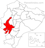
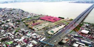
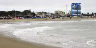
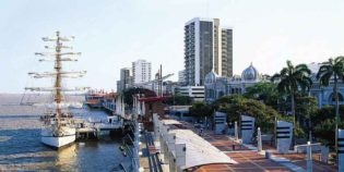
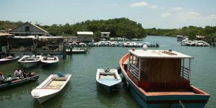
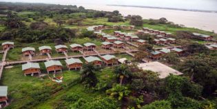
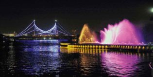
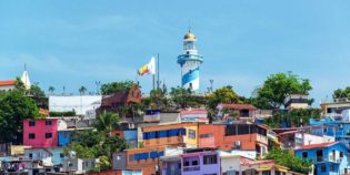
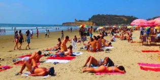
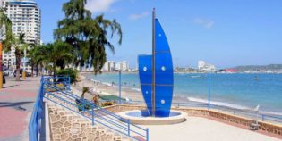
Guayas is a coastal province in Ecuador. Located in the central area of the coast, in a region washed by the Pacific Ocean and the Guayas river basin (hence its name). Guayaquil is its capital — Ecuador's biggest city, leading commercial center, and a major port. In fact, many tourists visit this city is to get on a flight or cruise to the Galapagos Islands. Guayas province has various destinations and points for different kinds of tourism. Main destinations are Guayaquil and the route to Samborondón — most of the middle- and upper- class families live in this area. Likewise, the main tourist attractions are near Guayaquil.

Guayas has a well-developed infrastructure for holding national and international events.  Also, it welcomes several types of industries. Some examples are manufacture food products, textiles, tobacco, chemicals, plastic, and timber. Some inhabitants of this place work in farming, animal breeding, or fishing.

There are only two seasons rainy and dry. Dry season goes from June to December, days are warm and nights are cool. While the rainy season goes from January to May, hot and humid. Due to the lesser rain, the best time for traveling is from June to November, The driest month is July. The temperature typically varies from 69°F to 90°F (21°C to 32°C).

Local holidays are Foundation of Guayaquil on July 25, Independence of Guayaquil on October 9, Cantonization of Samborondón on October 31, Foundation of Duran on October 16 and Cantonization de Milagro on September 17.

Click here to see Tourist Attractions Map of (Guayaquil) Guayas, Ecuador

Facts & Information

Language: Spanish
Currency: US Dollar

Location: South America
Country: Ecuador
Region: Coast
Capital: Guayaquil

Dial code: +593 4
Time zone: UTC-5
Elevation: ‎13.2 ft (4 m)

Temp: 69°-90°F (21°-32°C)
Weather / Climate

Top tourist attractions to see
Points of Interest & landmarks

Best places to visit
Tourist destinations / Cities & towns to go

Duran is a canton of Ecuador, located in the Guayas Province, near Guayaquil. The climate in Duran is tropical. During the rainy season, from December to April, weather is sunny, ...
General Villamil Playas is known simply as "Playas" is the closest beach to Guayaquil, Ecuador. Only 60 mi (96 km) away — an hour's drive by car. General Villamil Playas ...
Guayaquil is Ecuador's largest city, major port, leading commercial center, and capital of the Guayas province. It is famous for being the gateway to the Galapagos Islands and for its ...
Puná Island is a large island off the coast of the Gulf of Guayaquil, Ecuador. It has a protected area of 855 square km., well known for its great mangroves ...
Samborondón is a canton in the province of Guayas, Ecuador. Samborondón is located in the lower basin of the Guayas River, which separates it from Guayaquil. Also known as "The ...

Sightseeing / Day trips
Popular things to do

Bird-watching, National Parks & Ecological Reserves
Cerro Blanco Forest is a tropical dry forest reserve in the Guayas province, Ecuador. It is located 20 minutes from the city of Guayaquil. Cerro Blanco supports more than 500
National Parks & Ecological Reserves
Santay Island (Isla Santay in Spanish) is a recreation area located between the cities of Guayaquil and Duran, in the Guayas river. Guayaquil and the Santay Island are connected through
National Parks & Ecological Reserves
Churute Mangroves Ecological Reserve near Guayaquil. It is the largest protected area of Mangrove Forest in Ecuador. It contains approximately 50,000 hectares of mangroves and dry tropical forests. Manglares Churute is

Volcanoes & Mountains
Guayaquil is a coastal city with no volcanoes, but Chimborazo is the closest volcano to Guayaquil. Mount Chimborazo lies some 137 m. (222 km.) west from Guayaquil. Chimborazo is the highest

Parks, Rivers, Lakes & Lagoons
Forestal Park, “Parque Forestal” in Spanish, is a park in Guayaquil, Ecuador. It has 24 acres (10 hectares) that include a forest area, a lake, a children’s playground area, a
Rivers, Lakes & Lagoons
Malecón del Salado is a linear park/boardwalk along the estuary Salado. It is a well-known place in Guayaquil, Ecuador. The area is distributed on two floors. Malecon del Salado has beautiful
Historic Buildings & Landmarks, Rivers, Lakes & Lagoons
Las Peñas neighborhood is a colorful colonial place located next to the Guayas River in Guayaquil. Located at the end of the Malecón 2000, in the Santa Ana Hill. It
Rivers, Lakes & Lagoons
Malecón 2000 is a promenade that overlooks the Guayas River. Malecón 2000 is one of the most important and visited places in the city of Guayaquil, Ecuador. Malecón 2000 is

Waterfalls & Hot springs
7 Cascadas is a group of seven waterfalls located 57 mi. (91 km.) from Guayaquil, Ecuador. This is in the Cooperativa 23 de Noviembre, a small town in the Naranjal

Beaches & Surfing, Marine life (whales, dolphins, sea lions), Snorkeling & Scuba Diving
Puná Island is a large island off the coast of the Gulf of Guayaquil, Ecuador. It has a protected area of 855 square km., well known for its great mangroves
Beaches & Surfing, Spondylus route
General Villamil Playas is known simply as “Playas” is the closest beach to Guayaquil, Ecuador. Only 60 mi (96 km) away — an hour’s drive by car. General Villamil Playas
Beaches & Surfing
Find the best Beaches near Guayaquil. Closest beaches to Guayaquil are located West of the city, on the Pacific Coast. The nearest beach is called “Playas”, located in the town of General

Bird-watching, National Parks & Ecological Reserves
Cerro Blanco Forest is a tropical dry forest reserve in the Guayas province, Ecuador. It is located 20 minutes from the city of Guayaquil. Cerro Blanco supports more than 500

Jungle Towns & Rainforest
Jungle towns and rainforests are found in the Amazon Basil. Nearest jungle towns to Guayaquil can be found traveling either to the north-east or to the south-east. To the south-east,

Map location / Where is it located?

Get Directions

  show options
error: Alert: Content is protected !!