Cotacachi-Cayapas Ecological Reserve

Cotacachi-Cayapas Ecological Reserve contains 752,235 acres (304418 hectares) of land. It extends from Imbabura – in the Ecuadorian Andes mountains to the western edge of the rainforest in the Esmeraldas. The reserve is only 87 miles (140 km) from Quito. Inside, there are three volcanoes: Yanahurco, Cotacachi, and Cuicocha. But, top attraction is the Cuicocha Lagoon. ... Read more

San Pablo lake
San Pablo Lake

San Pablo a lake formed by the water discharged by the waterfall Peguche. Located right at the foot of Imbabura volcano. 2.5 mi. (4 km.) west of  Otavalo, Ecuador. During the Yamor festival, communities gather to celebrate an open water swimming event. Around the San Pablo lake, there are indigenous villages, rushes, and green fields. Recreational activities include hiking, ... Read more

Yahuarcocha lake
Yahuarcocha lake

Yahuarcocha is a lake located 1.86 mi. (3 km.) Northern of Ibarra, Ecuador. Surrounded by natural viewpoints and an environment of indigenous crops and land. “Laguna Yahuarcocha” in Spanish. It means a lake of blood in the Quechua language (‘Yahuar’ – blood, ‘Cocha’ – lake). This is a reference to a battle that took place ... Read more

previous arrow
next arrow
Slider

Imbabura province

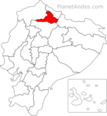
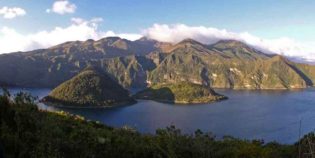
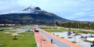
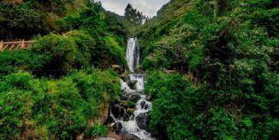
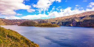
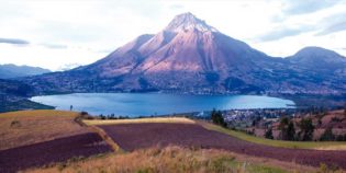
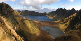
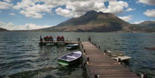
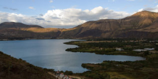
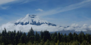
Imbabura is an Ecuadorian province with beautiful landscapes. Known as the "province of lakes". Because it has many lakes and lagoons. Imbabura has temperate valleys, snow-capped volcanoes, and spectacular waterfalls. Ibarra is its capital. The main attractions are the lakes of San Pablo, Yahuarcocha, Mojanda, and Cuicocha. As well as the Cotacachi-Cayapas Ecological Reserve and the Imbabura volcano. About activities, Imbabura is a great place for walking, hiking, and fishing. Imbabura's crafts have become famous worldwide. Indeed, Otavalo handcrafts are well known around the world. Artisans take pride in this fact. In the Otavalo market (Plaza de Los Ponchos) you can find high quality handcrafted textiles.

Some examples of traditional food are white-corn pastries, roast chicken, pork and guinea pig. And sweets such as blackberry syrup, and handmade ice cream. Imbabura celebrates several festivals including the harvest in honor of the sun. Known as "Fiesta de la Jora" in Spanish. Celebrated the first two weeks of September. Where is common to drink "chicha jora" — an alcoholic drink made of a kind of maize (dry corn).

There are only two seasons rainy and dry. The rainy season runs from January to May. While the dry season runs from June to December. The average temperature falls between 56°F to 76°F (13°C to 25°C).

Imbabura local holidays are Foundation of Ibarra and September 28 and Provincialization of Imbabura and June 25.

Facts & Information

Language: Spanish
Currency: US Dollar

Location: South America
Country: Ecuador

Region: Andes
Capital: Ibarra
Dial code: +593 6
Weather / Climate

Best places to visit
Tourist destinations / Cities & towns to go

Cotacachi is a small artisan town. Located in the Imbabura province, Ecuador. Cotacachi has amazing hot springs, lush forests, nature reserves, and snowy summits. Cotacachi's main production is leather goods. ...
Cuicocha is a caldera nestled within the crater of the Cotacachi volcano. It has an elevation of 10,649 ft. (3,246 m.) Located in the Imbabura province, in Ecuador. "Laguna Cuicocha" ...
Ibarra is a picturesque and city with cobbled streets, the capital of Imbabura. Located in the middle of the Andean highlands of Ecuador. Also, known as "The White City" because ...
Otavalo is an indigenous city, surrounded by volcanoes. Located 68 mi. (110 km.) from the north of Quito, Ecuador — about a two-hour bus drive. — Otavalo is known as the ...

Sightseeing / Day trips
Popular things to do

Cotacachi-Cayapas Ecological Reserve contains 752,235 acres (304418 hectares) of land. It extends from Imbabura - in the Ecuadorian Andes mountains to the western edge of the rainforest in the Esmeraldas. The ...
Imbabura is an inactive volcano with a peak elevation of 14,952 ft. (4,557 m.) height above the sea level. It has two main summits. One of the 100 m. higher ...
Mojanda lakes are three turquoise lagoons nestled in the Andes Highlands. They are amongst once-active volcanoes. Located in the Imbabura province, near Otavalo. "Lagunas de Mojanda" in Spanish. It has ...
Peguche waterfall is one of the main attractions in Otavalo and its surroundings. Located 1.86 mi. (3 km.) North of Otavalo and 14 mi. (23 km.) South of Ibarra. "Cascadas ...
Protected Forest of Peguche is one of the most beautiful rainforests in northern Ecuador. This forest has a big area for camping and picnics. As well as a well-maintained trail ...
San Pablo a lake formed by the water discharged by the waterfall Peguche. Located right at the foot of Imbabura volcano. 2.5 mi. (4 km.) west of  Otavalo, Ecuador. During the Yamor ...
Yahuarcocha is a lake located 1.86 mi. (3 km.) Northern of Ibarra, Ecuador. Surrounded by natural viewpoints and an environment of indigenous crops and land. "Laguna Yahuarcocha" in Spanish. It ...

Map Location / Where is it located?

Get Directions

  show options
error: Alert: Content is protected !!