Imbabura volcano
Imbabura volcano
Imbabura volcano
Imbabura volcano
Imbabura volcano
previous arrow
next arrow
Slider

Imbabura volcano

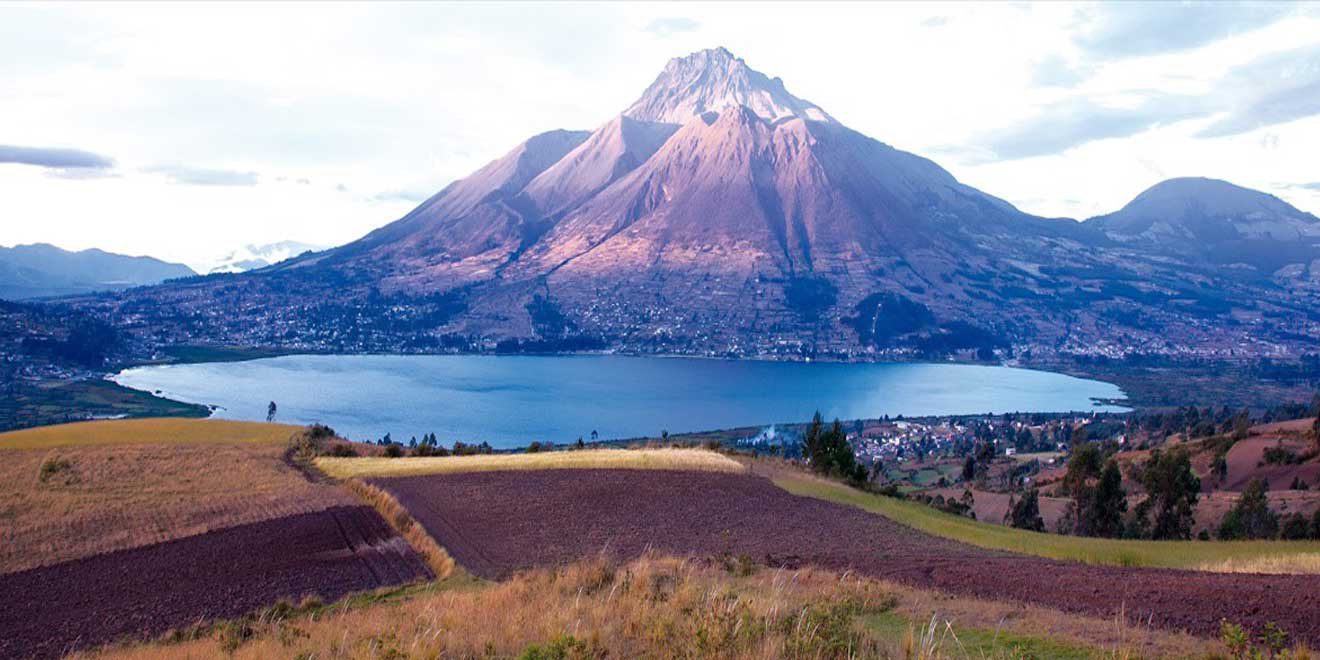
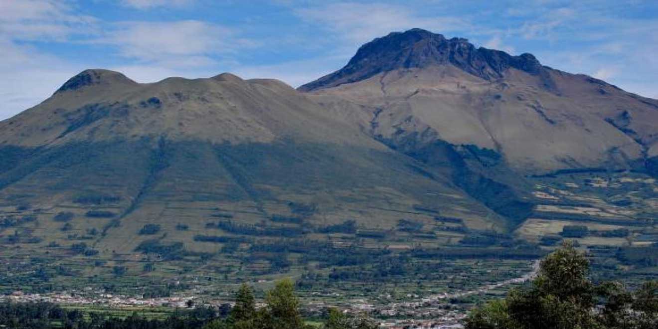
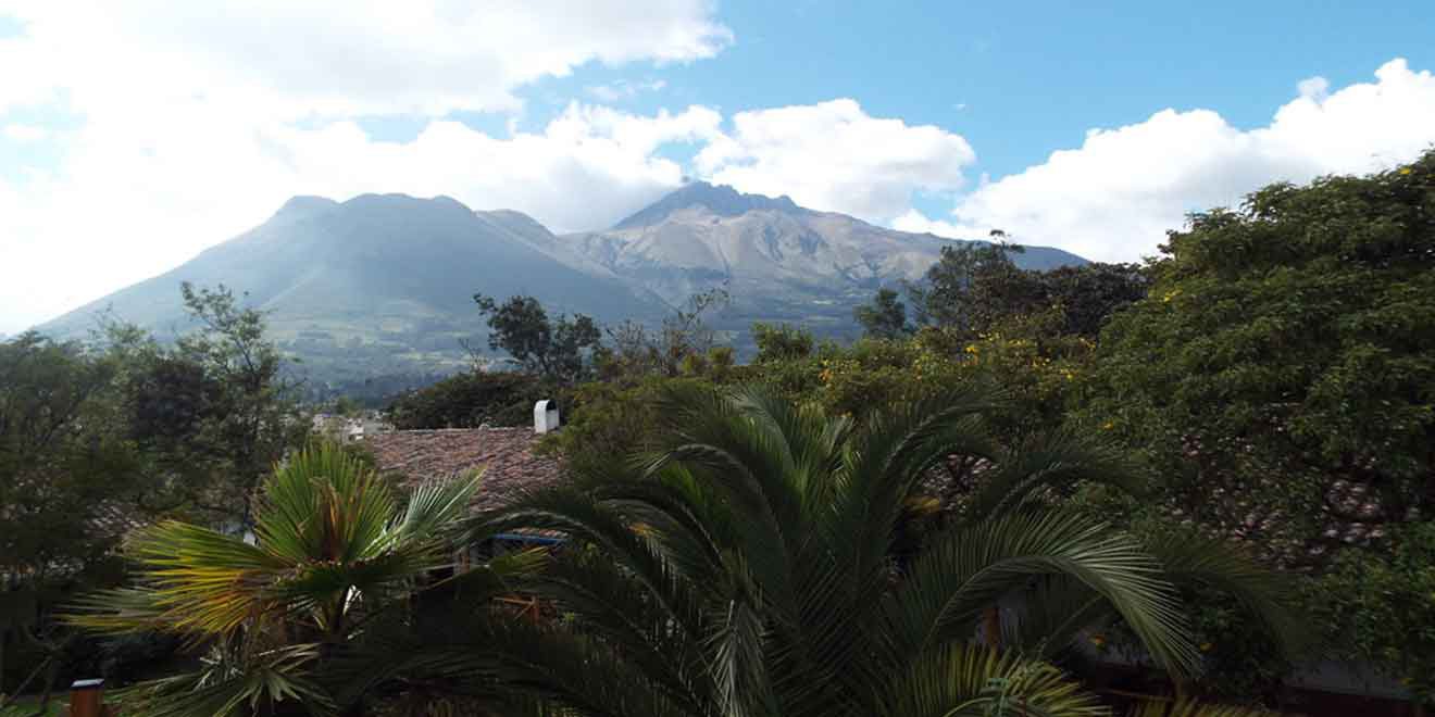
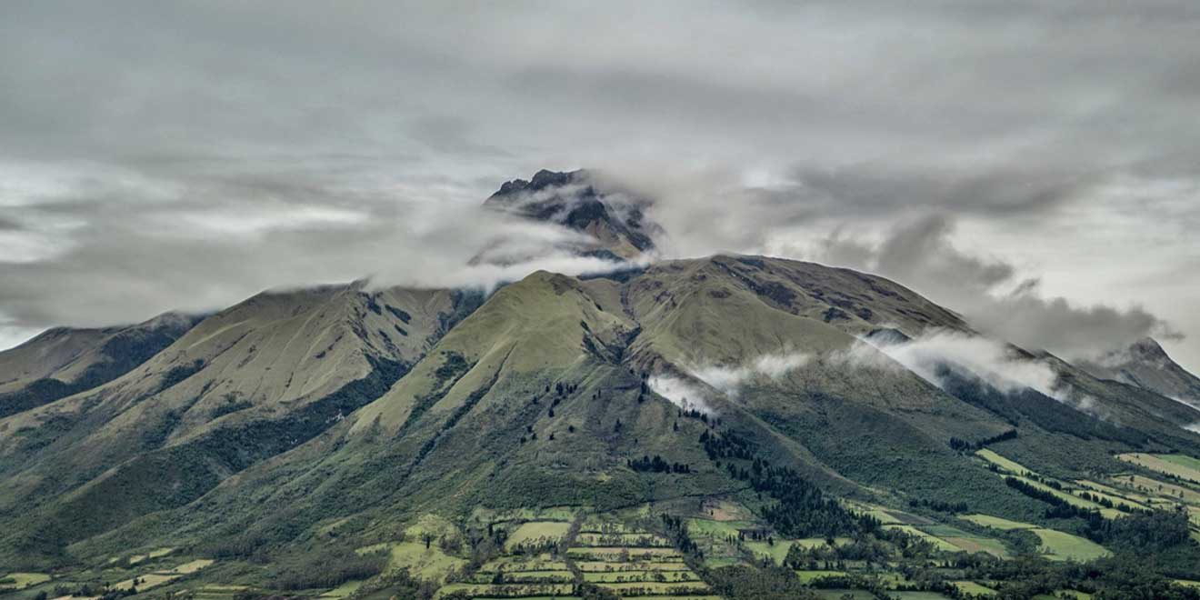
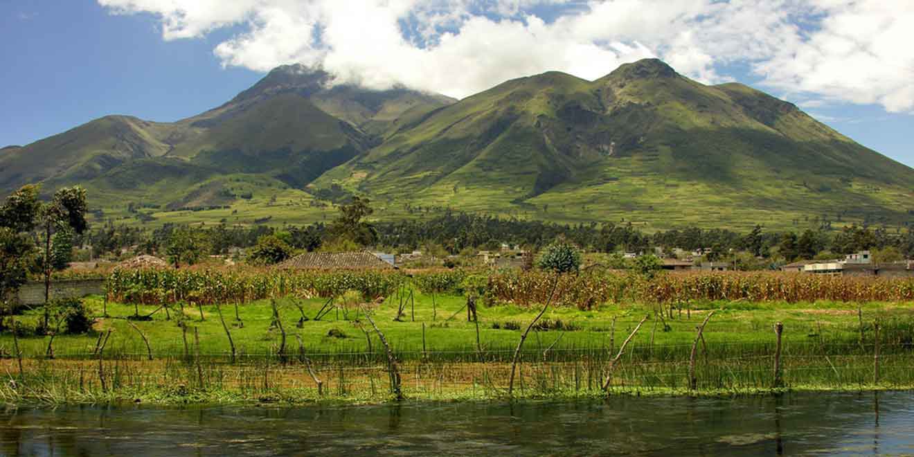
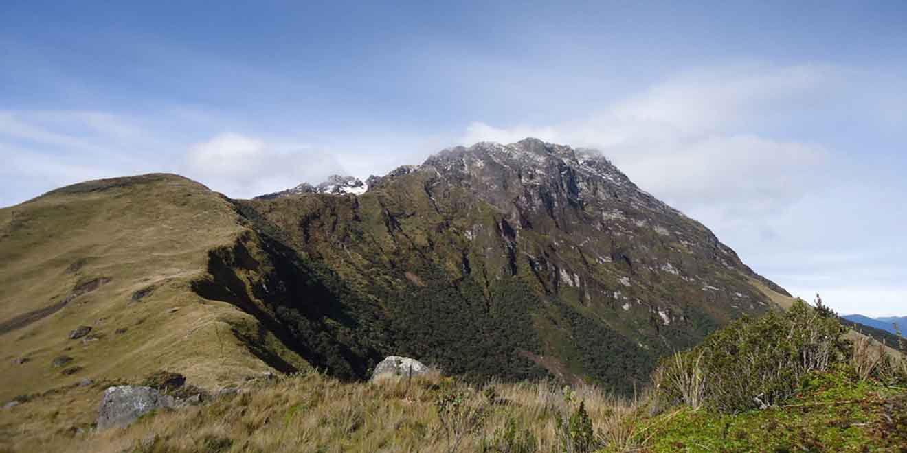
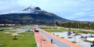
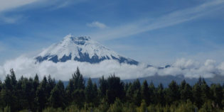
Imbabura is an inactive volcano with a peak elevation of 14,952 ft. (4,557 m.) height above the sea level. It has two main summits. One of the 100 m. higher than the other. The Imbabura volcano is located near the Lago San Pablo outside of Otavalo town, in the Imbabura province of Ecuador. This is about 37 mi. (60 km.) Northeast of Quito. Known as "Tayta Impapura" in Quechua. The slopes of this volcano are very fertile. In fact, from the distance, you can see the different colors that the farmed land has. Hiking the mountain offers spectacular views of surrounding hills. As well as views of the Cayambe volcano, and the Cuicocha crater lake. It is definitely worth it.

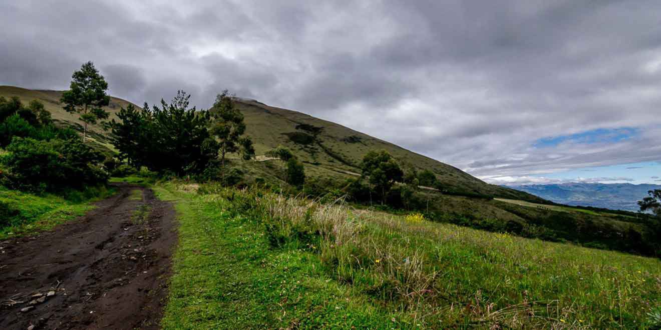
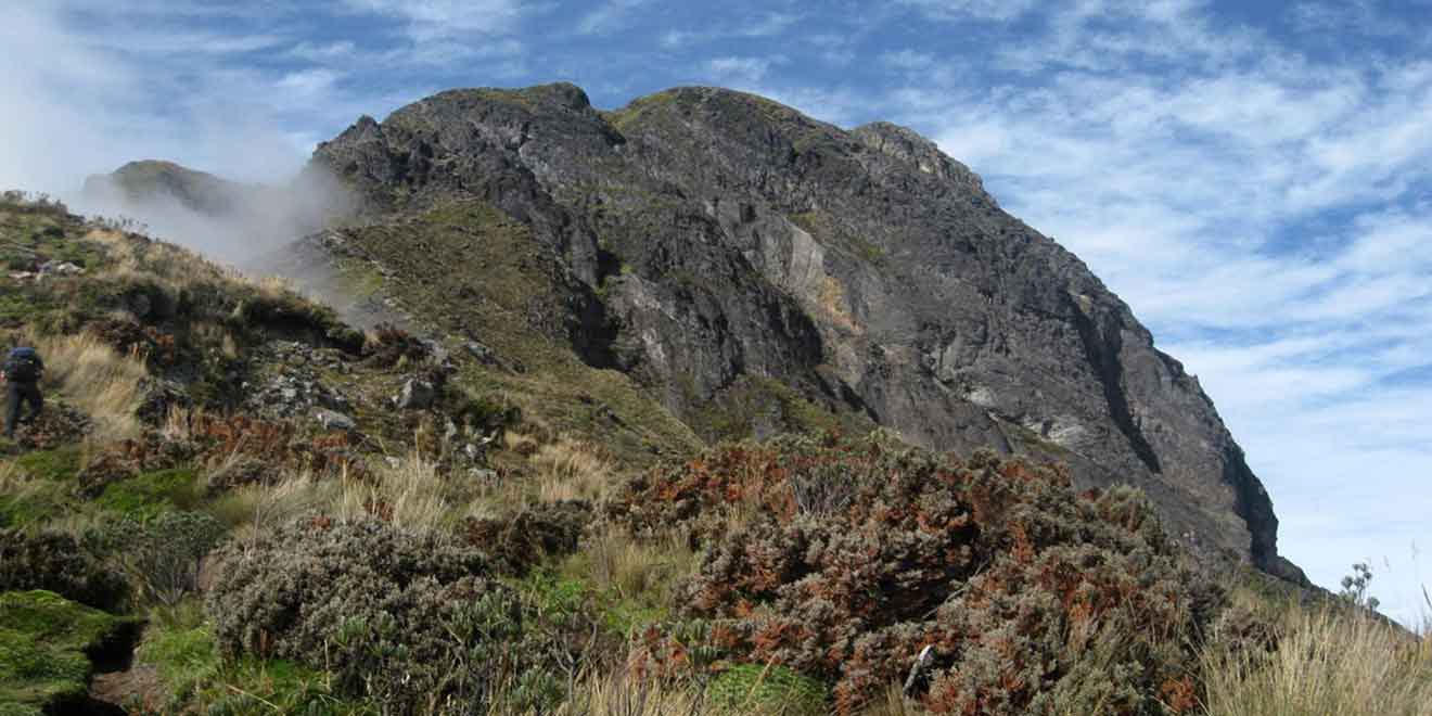
Imbabura gentle slopes make it a great place for trekking. It is the perfect place for acclimatization to the altitude. In particular, if you are preparing to climb a higher mountain such as Cotopaxi or Chimborazo. The best time to visit is during the dry season. Especially from June to August or from December to February.

The closest town, to this mountain, is the village of La Esperanza. From Ibarra or Otavalo, you can take a bus in the local Terminal Terrestre (bus station). Tickets cost $2 to $2.5 one way. Once in La Esperanza, you can rent a taxi for $4-$5 to get you to the Imbabura rail to start trekking. There is no entrance fee.

Facts & Information

Language: Spanish
Currency: US Dollar

Location: South America
Country: Ecuador

Region: Andes
Province: Imbabura
Nearest city: Ibarra, Otavalo

Altitude: 14,952 ft (4,557 m)
Coordinates: 0.26°N 78.18°W
Weather / Climate

Photos / Images / 360 Street view

Map location / Where is it located?

Get Directions

  show options

Nearby destinations to go

Cotacachi is a small artisan town. Located in the Imbabura province, Ecuador. Cotacachi has amazing hot springs, lush forests, nature reserves, and snowy summits. Cotacachi's main production is leather goods. ...
Cuicocha is a caldera nestled within the crater of the Cotacachi volcano. It has an elevation of 10,649 ft. (3,246 m.) Located in the Imbabura province, in Ecuador. "Laguna Cuicocha" ...
Ibarra is a picturesque and city with cobbled streets, the capital of Imbabura. Located in the middle of the Andean highlands of Ecuador. Also, known as "The White City" because ...
Otavalo is an indigenous city, surrounded by volcanoes. Located 68 mi. (110 km.) from the north of Quito, Ecuador — about a two-hour bus drive. — Otavalo is known as the ...

Other attractions to visit
Points of Interest & landmarks

Mojanda lakes are three turquoise lagoons nestled in the Andes Highlands. They are amongst once-active volcanoes. Located in the Imbabura province, near Otavalo. "Lagunas de Mojanda" in Spanish. It has ...
Peguche waterfall is one of the main attractions in Otavalo and its surroundings. Located 1.86 mi. (3 km.) North of Otavalo and 14 mi. (23 km.) South of Ibarra. "Cascadas ...
San Pablo a lake formed by the water discharged by the waterfall Peguche. Located right at the foot of Imbabura volcano. 2.5 mi. (4 km.) west of  Otavalo, Ecuador. During the Yamor ...
Yahuarcocha is a lake located 1.86 mi. (3 km.) Northern of Ibarra, Ecuador. Surrounded by natural viewpoints and an environment of indigenous crops and land. "Laguna Yahuarcocha" in Spanish. It ...
Protected Forest of Peguche is one of the most beautiful rainforests in northern Ecuador. This forest has a big area for camping and picnics. As well as a well-maintained trail ...
Cotacachi-Cayapas Ecological Reserve contains 752,235 acres (304418 hectares) of land. It extends from Imbabura - in the Ecuadorian Andes mountains to the western edge of the rainforest in the Esmeraldas. The ...
error: Alert: Content is protected !!