Agoyán waterfall
Agoyan Waterfall

Agoyán waterfall is the tallest waterfall of the Ecuadorian Andes. It has 132 ft. (40 m.)  of height. It is located in the Tungurahua province. Approximately 4.3 mi. (7 km.) from the city of Baños de Agua Santa. In the road Baños – Puyo. Agoyán waterfall flows into the Pastaza River. Stopping by the Agoyán waterfall is one of the popular things to do if visiting ... Read more

Baños de Agua Santa
Manto Novia waterfall. Banos. Tungurahua, Ecuador

Baños de Agua Santa or “Baños” is a beautiful town located in the Tungurahua province, Ecuador. Baños means “springs” and Agua Santa means “holy water.” This town possesses natural beauty, surrounded by lush vegetation, waterfalls, rapid rivers, and thermal springs. Hence its name, holy hot springs. The closest cities are Ambato and Riobamba. The movie Proof ... Read more

Patate
Panoramic view of Patate

San Cristóbal de Patate or just “Patate” is part of the Llanganates National Park in the Tungurahua province, Ecuador. This is 25 minutes from Ambato and two and a half hours south of Quito. Patate has become a popular destination for volcano-watchers. This city has great views of the Tungurahua volcano – which is constantly ... Read more

previous arrow
next arrow
Slider

Tungurahua province

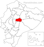
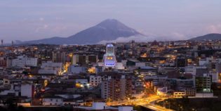
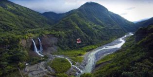
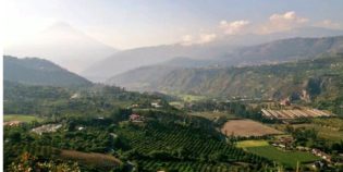
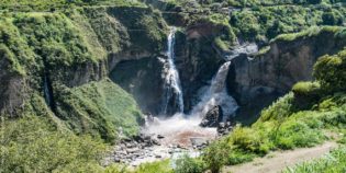
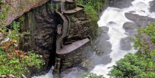
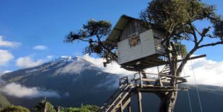
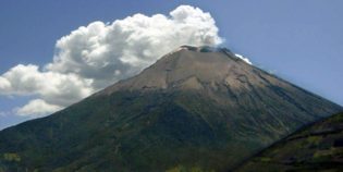
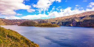
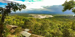
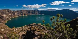
Tungurahua is an Ecuadorian province. Ambato is its capital. Tungurahua volcano is one of its main attractions. Other attraction is the Devil's Cauldron. "Pailon del Diablo" in Spanish. Tungurahua main destinations are the town of Baños de Agua Santa and Ambato. In fact, the movie Proof of Life was filmed near Baños. In addition, this province is near some important volcanoes such as Chimborazo, Carihuayrazo, and El Altar.

In Tungurahua, the climate is comfortable and overcast. The average temperature varies from 50°F to 69°F (10°C to 21°C). Usually, days are warm, whit cooler nights. There are only two seasons dry and rainy. Dry season goes from June to December, while rainy season goes from January to May.

Local holidays are Fiesta of Fruits and Flowers on March 4-5, and Independence of Ambato on November 12.

Facts & Information

Language: Spanish
Currency: US Dollar

Location: South America
Country:Ecuador
Region: Andes
Capital: Ambato

Dial code: +593 3
Time zone: UTC-5
Elevation: 8,917 ft (2,718 m)

Temperature: 50° to 69°F (10° to 21°C)
Weather / Climate

Best places to visit
Tourist destinations / Cities & towns to go

Ambato is a nice city, the capital of the Tungurahua province. It is the major hub for travelers heading from Quito to Riobamba o Guayaquil. Ambato's full name is "San ...
Baños de Agua Santa or "Baños" is a beautiful town located in the Tungurahua province, Ecuador. Baños means "springs" and Agua Santa means "holy water." This town possesses natural beauty, ...
San Cristóbal de Patate or just “Patate” is part of the Llanganates National Park in the Tungurahua province, Ecuador. This is 25 minutes from Ambato and two and a half ...

Sightseeing / Day trips
Popular things to do

Agoyán waterfall is the tallest waterfall of the Ecuadorian Andes. It has 132 ft. (40 m.)  of height. It is located in the Tungurahua province. Approximately 4.3 mi. (7 km.) from the city of Baños de Agua ...
Treehouse or "Casa del Arbol" is a must to do in Baños de Agua Santa, Ecuador. The treehouse is built on the edge of one of the mountains next to the ...
Tungurahua is an active volcano with an elevation of 16,475 ft. (5,023 m.) above sea level. It is an impressive symmetric volcano, but its summit is usually under clouds. Located in ...

Map Location / Where is it located?

Get Directions

  show options
error: Alert: Content is protected !!