Llanganates National Park
previous arrow
next arrow
Slider

Llanganates National Park

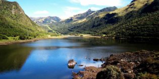
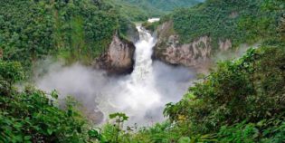
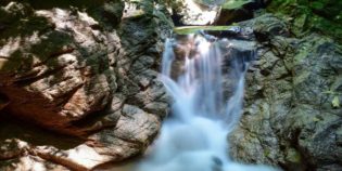
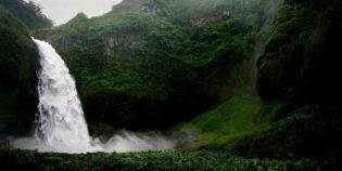
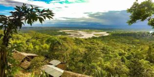
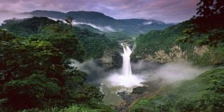
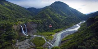
Llanganates National Park is a protected area part of the Tungurahua and Napo in Ecuador. This park has stunning lakes, rivers, mountains, and cloud forests. Llanganates means "beautiful hill". The Llanganates Mountains Range also part of the park holds the myth of a hidden treasure. Legend has it that in ancient times general Rumiñahui ordered here, the burial of the El Dorado treasure. The gold was to pay the Spaniards a ransom for the Inca emperor Atahualpa. While it may be true, Llanganates National Park real treasure is its landscape and biodiversity.

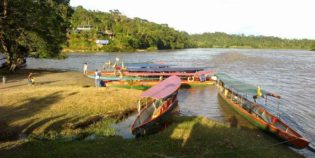
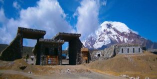
Llanganates is 37 mi. (60 km.) NorthEast of Ambato, and only 20 mi. (32 km.) from the town of Baños de Agua Santa, which is located at the entrance of the Amazon. If you are in Quito, take the Quito-Ambato road 82 mi. (132 km.) From Ambato, take the route to Pillaro to San Jose de Poalo, until you reach the refuge of Sunfopamba.

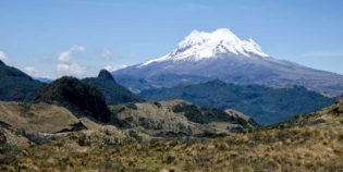
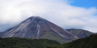
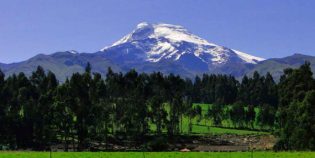
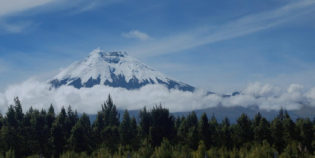
Llanganates National Park characterizes by its grassy and marshy Andean Highlands. Altitudes in the park range between 3,937 ft. to 14,997 ft. (1,200 m. to 4,571 m.) The highest mountain in the park is Cerro Hermoso at 14,993 ft. (4,570 m.)  So, this variation in altitude causes extreme changes in temperature. The park admission costs $10. Camping costs $2.

Facts & Information

Language: Spanish
Currency: US Dollar

Location: South America
Country: Ecuador
Region: Amazon
Provinces: Cotopaxi,Pichincha,Tungurahua,Napo
Weather / Climate

Photos / Images / 360 Street view

Map location / Where is it located?

Get Directions

  show options

Nearby destinations to go

Papallacta is a small town located in the Napo province, 20 miles west from Quito. Nestled between the Cayambe and the Antisana volcanoes. The town has an elevation of 10,800 ft. ...
Tena is a peaceful town, capital of the Napo province, Ecuador. Tena is also known as "Cinnamon Capital" — "Capital de la Canela" in Spanish. "Canela" means "cinnamon" — Tena ...
Antisana Ecological Reserve is a protected area. Located in Napo, Ecuador. About 62 mi (100 km) from Quito. The centerpiece of this nature reserve is the Antisana Volcano. Ecuador's fourth ...

Other attractions to visit
Points of Interest & landmarks

Reventador is one of Ecuador's most active volcanoes. It has an elevation of 11,683 ft. (3,562 m.) above sea level.  The caldera is 2.5 mi. (4 km.) wide in diameter. ...
Rio Malo waterfall is a waterfall located in the Napo province, in the Amazon Region of Ecuador. It is part of The Cayambe-Coca Ecological Reserve. This waterfall has a fall of ...
Pimpilala waterfalls are located in the community of Cando, parish Talag, southwest of the city of Tena. Tena is the capital of the Napo province, in the Amazon Region of ...
San Rafael waterfall, in the Coca River, is one of the largest waterfalls in the eastern part of Ecuador. This waterfall has a fall of more than 492 ft. (150 ...
Cayambe Coca National Park is a protected area of damp forests and high grass plains. It extends throughout the provinces of Imbabura, Pichincha, Napo, and Sucumbios. Located about 24 mi. ...
error: Alert: Content is protected !!