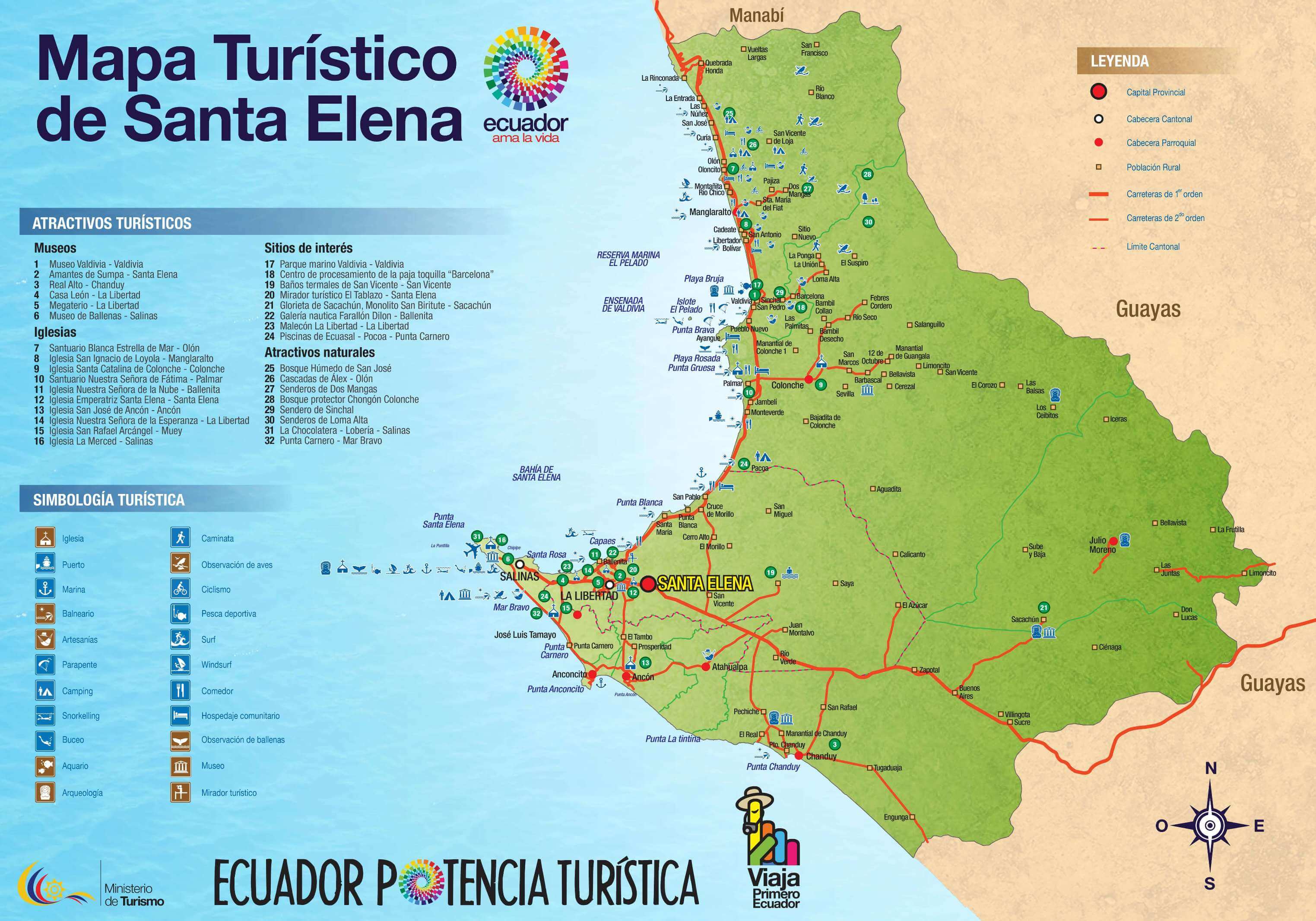
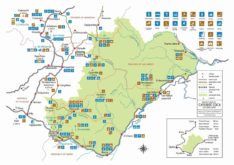
Here find a tourist map of the Santa Elena province of Ecuador. Santa Elena city and its surrounding towns and attractions. Need more information about traveling to Ecuador? Click here to see more Ecuador travel maps or Click here to see more resources on how to prepare your trip.
Tourist Attractions Map of Santa Elena, Ecuador
Map of Santa Elena, Ecuador. Free download. Image
1 file(s) 470 KB
Map of Santa Elena, Ecuador. Free download. PDF
1 file(s) 681 KB
Source: Ecuador National Tourism Office (Ministerio de Turismo)
Top tourist attractions
Santa Elena province
Santa Elena is a coastal Ecuadorian province. Its capital shares the same name. Santa Elena is located on an Ecuadorian peninsula near the city of Guayaquil. This province has some of the most beautiful beaches in the country.
Punta Carnero is a beach on an island located in the province of Santa Elena, 10 minutes by car from Salinas, Ecuador. It is one of the best places to ...
La Libertad is a clean and organized coastal town located in Santa Elena, Ecuador. It is considered the largest commercial center in the Santa Elena peninsula. La Libertad has a ...
Playa Rosada or pink beach is a coastal town located in Santa Elena province, Ecuador. Playa Rosada is a tranquil, secluded, pink-sand gem. This beach keeps its virgin nature and ...
Santa Elena is a coastal town, capital of the province of the same name. Santa Elena main attractions are its beaches. One of its main destinations is the "Ruta del ...